Unit 7 Plan: Building a State

Unit Summary

If the 18th century in New Hampshire had been about the creation of sustainable local communities, the first half of the 19th century was about unifying those towns and communities into one state. The concept of “New Hampshire” as a unique locality with its own characteristics and identity didn’t really begin to emerge until after the American Revolution. Economic changes, particularly the beginnings of industrialization, emphasized people’s connections to the larger world, as they increasingly purchased the food and items they needed, rather than producing it themselves. As consumers, people were dependent on a supply chain that brought goods from great distances to their local markets. It was a marked shift from the self-sufficient farms and insular towns that had characterized life in the 18th century, and a change that moved New Hampshire, and the rest of the country, increasingly toward what we would recognize as the modern world.

You're on page

The Big Picture

New Hampshire in the late 18th and early 19th centuries was just developing a sense of unity—the idea that all the towns spread throughout the state were linked with one another in a larger entity, the state of New Hampshire. Increasingly, the people of New Hampshire looked beyond the borders of their own towns. And as the towns were unifying into one state during this time, so too were the 13 states joining together to create the United States. As you read this unit, keep in mind the following points:

  • The development of transportation networks transcended local communities and made travel more feasible. Through roads, canals, and eventually railroads, people and goods moved throughout New Hampshire (and beyond). Such connections fostered more communication over greater distances and a greater awareness of state, regional, and national affairs.
  • Industrialization increased this sense of connectedness with the larger world. Factories created products from raw materials shipped into New Hampshire from elsewhere and then sold their products to markets located throughout the Northeast and beyond. People’s jobs and economic welfare thus grew dependent on wider forces that existed outside of their local communities.
  • Self-sufficient farmers of the 18th century also began to cultivate products to sell, making them reliant on economic markets beyond town borders. The New England family became consumers of goods, buying most of their food and other items at stores rather than producing these goods themselves. With the shift to a market economy, the barter system gave way to a currency-based economy, that, again, was influenced by larger, inter-related economic forces outside the local community.
  • New areas of the state were settled, particularly the Lakes Region, the White Mountains, and the North Country. This expansion prompted New Hampshire to resolve the last of its boundary issues during the early 19th century. The state annexed the Indian Stream Republic (present-day Pittsburg) and defined its border with Canada via the 1842 Webster–Ashburton Treaty. The settling of these geographical issues resulted in the borders New Hampshire has today.
  • A state culture subtly began to emerge that would come to characterize New Hampshire for decades to come, bolstered by the formation of statewide organizations, such as the New Hampshire Historical Society. New Hampshire’s capital was set in Concord and a large state house built, the so-called “people’s state house,” which served as the focal point for statewide ceremonies and special occasions. New Hampshire also got the nickname the “Granite State” in these years and cultivated a reputation for toughness and determination.

Creating a Transportation Network

What transportation infrastructure emerged during this period, and how did it help communities connect with one another?

The rapid development of towns that had begun in the 18th century continued well into the 19th century. New land was settled and towns formed, particularly in the Lakes Region, the White Mountains, and the Great North Woods. Even in the settled areas of New Hampshire, new towns were founded, as communities and villages seceded from larger towns. In fact, New Hampshire’s four original settlements eventually split into 25 different towns. By 1850, New Hampshire was well and truly settled, with nearly 250 towns reaching to the edges of all four of its borders.

Once the hard work of founding a new settlement was over, people began to look beyond the borders of their towns. Travel was hard, uncomfortable, and painfully slow at this time, but the needs of business and government, in addition to personal connections, highlighted the importance of being able to move people and goods around the state. The creation of transportation networks, whether roads, canals, or trains, encouraged greater interaction between the people of New Hampshire and cultivated a consciousness that the society in which they lived was larger than their town borders.

Roads. In the 18th century, each town was responsible for building and maintaining their own roads, and all roads were local. There were no highways or interstates that linked communities together. The townspeople determined where roads would be built, and there was no larger plan to provide rhyme or reason to the road network. The result was a zig-zag pattern of roads and byways, many of which were so rocky as to be nearly impassable on horseback. In the 1760s and 1770s, the colonial legislature passed a series of highway acts to impose some order on the road network, but the laws did not assign any money to the effort, and the movement to create a more sensible transportation network to link communities failed. The responsibility for the roads remained with each individual town.

By the 1790s, the need for better transportation around the state had become more critical. The spread of development, the need for self-governing bodies to meet, discuss, and decide, and the growing interest in buying and selling goods all necessitated decent transportation. People needed to be able to get from Point A to Point B in a reasonable fashion. Thus, in 1796, the New Hampshire legislature incorporated what became the First New Hampshire Turnpike, running from Concord to Portsmouth. It was a private road, owned and operated by a group of investors who charged a toll (usually a penny) to those who used the road. Gatehouses appeared at intervals on the road where the fee was collected. The building of the First New Hampshire Turnpike set off a period of road construction in New Hampshire that resulted in roughly two dozen turnpikes covering 600 miles of road that crisscrossed the state between 1796 and 1809. (Many of these turnpikes eventually evolved into the state highways we still use today.) The Tenth New Hampshire Turnpike, opened in 1803, even blazed a path through an area of the White Mountains that would become known as Crawford Notch, allowing travel to the Great North Woods. It was rough going through the mountains, though, and horses initially had to be helped over the rocks that comprised the turnpike through the narrowest part of the pass. Nevertheless, the Tenth New Hampshire opened a whole new area of New Hampshire to development.

Turnpikes were substantially better built than town roads and made travel easier. They had fewer rocks, were graded to minimize changes in elevation, included sturdy bridges to cross rivers and streams, and were even designed to provide drainage for excess water, which cut down on flooding and the amount of mud. But these roads would still be considered primitive by today’s standards.

Travel by turnpike was slow, arduous, and dirty. Most people walked (covering an average of 14–18 miles per day), rode on horseback (at roughly 35 miles per day), or traveled by wagon or private carriage (which fell somewhere in between). A lack of maps or signage, other than granite mile markers that can still be seen today, meant that it was often difficult for travelers to find their way. Because the pace of travel was so slow, getting lost or taking a wrong turn could result in a serious loss of time and effort. Everyone traveled by day, as nighttime travel increased the chances of getting lost. Unsurprisingly, travel was also seasonal in New Hampshire, but it wasn’t winter that presented the greatest challenges to travelers, many of whom wore snowshoes or used sleighs. Spring proved the most difficult season to be on the roads, as mud often made both the turnpikes and town roads impassable.

In the early decades of the 19th century, public stagecoaches—the first form of public transportation—became popular in New Hampshire. The public stages carried not only passengers but also the mail and newspapers, providing a means for reliable communication between communities. Traveling by stagecoach was challenging as well. Stages could be crowded—sometimes carrying as many as 16 people sitting on one another’s laps!—and both accidents and breakdowns were common occurrences.

Stagecoaches were known for giving passengers a bumpy ride, especially when the conditions of the roads were poor. But a pair of New Hampshire craftsmen, Lewis Downing and J. Stephens Abbot, sought to improve the passenger experience with the development of what became known as the Concord coach. The Abbot-Downing Company of Concord, which opened its doors in 1828, designed a flexible harness system for the frame of the coaches that allowed the main compartment of the coach to swing rather than bounce, leading to a much smoother, more comfortable ride. The Concord coach became the standard for stagecoaches by the middle of the 19th century, and the Abbot-Downing Company produced hundreds of them and shipped them all around the world, even as far away as Australia.

Travel by road may have been difficult, but the creation of an intrastate road system and the establishment of public transportation options were important steps in linking people in communities around New Hampshire.

Canals. Discouraged by the challenges of overland travel, many people turned to New Hampshire’s rivers instead. The Abenaki had long used the rivers to travel great distances, making them, for all intents and purposes, their highways. In the late 18th and early 19th centuries, Americans in general were in the midst of what became known as “canal fever,” culminating in projects like the Erie Canal that linked the Great Lakes with the Hudson River in New York. New Hampshire’s 40,000 miles of rivers made the possibilities of water travel particularly attractive, although the many falls and rapids presented challenges for those attempting to use the state’s waterways for transportation. The only way to make New Hampshire’s rivers navigable was to build locks and canals to allow travelers to bypass the waterfalls.

The Merrimack River was the most logical place to start. The mighty river ran through Concord, Manchester (called Derryfield until 1810), Nashua, and Lowell and emptied into the Atlantic at Newburyport, Massachusetts. In 1803, the possibilities for water travel became even greater when the Middlesex Canal opened, linking the Merrimack River at Lowell to Boston Harbor. The canal did much to open Boston markets to New Hampshire farmers, even if the Amoskeag Falls prevented river travel further north than Manchester. The falls were the largest in New Hampshire and were a significant obstacle. Beginning in 1794, a Goffstown merchant named Samuel Blodgett had been trying to build a canal around the falls but hadn’t met with much success. None of his designs proved sufficient, and he bankrupted himself in the process. Finally, in 1807, after the state legislature allowed him to hold a lottery to raise funds for another attempt, Blodgett’s one-mile canal opened on the Merrimack River, allowing boats to circumvent the Amoskeag Falls and travel north. (Pieces of Blodgett’s canal can still be seen today near the Amoskeag Bridge.) By 1815, the Merrimack River had been made navigable all the way to Concord.

Travel by water was seasonal and still slow. The trip from Concord to Boston could take 4–5 days. More goods than people traveled on the river, carried on 75-foot longboats or rafts made of tree trunks tied together with rope. Plans were made to build an extensive canal system throughout New Hampshire, with an effort to make the Connecticut River navigable all the way to the St. Lawrence River in Canada. Another canal was expected to link Lake Winnipesaukee to the Piscataqua basin on the seacoast. Such efforts were expensive, though, and “canal fever” in New Hampshire proved as brief as it was in the rest of the United States. Before the plans could be put into effect, a new form of transportation had emerged that made water travel obsolete—the railroads.

Railroads. Invented in Great Britain, the first steam trains began operating in the United States in 1827 in the Mid-Atlantic region with the Baltimore & Ohio Railroad. Trains caught on quickly, and soon tracks were being laid throughout the country, particularly in the Northeast. New Hampshire got its first rail line in 1838, with an 18-mile stretch spanning from Lowell to Nashua. Rail travel had several advantages over other forms of transportation. It was faster than any other options available at the time; it required less maintenance than roads, even if the initial investment was more expensive; it could move large amounts of goods and people; and rail lines could be laid almost anywhere in New Hampshire, making nearly every corner of the state accessible.

Initially, though, the effort to bring railroads to New Hampshire became mired in a political battle known as the Railroad War of 1840–1844. Although rail companies were private businesses, the state legislature had to approve each venture, as train tracks crossed town lines. The disagreement over the railroad was between two factions of the Democratic Party, which was the only viable political party in New Hampshire at the time. (The Democratic Party of the 19th century bore little resemblance to the Democratic Party today. Then, it championed small government, a rural economy, and states’ rights.) One faction saw the potential of railroads to support the state’s growing industrial sector and related trade. The other faction feared that the railroads would disrupt traditional agricultural patterns in New Hampshire. Eventually, the pro-railroad faction gained the upper hand, and dozens of small rail companies emerged in the 1840s and 1850s, which created a patchwork of rail lines throughout the state. By the end of the century, all these little companies had been gobbled up by the Boston & Maine Railroad, which grew to dominate rail travel in northern New England.

The impact of the railroad on New Hampshire was enormous. For the factories that were being built all over the state, railroads brought them raw materials and allowed them to send their finished products to market. Trains also offered a way for thousands of immigrants to reach the factories and cities in which they would build their new lives. These factors were essential in allowing the state’s Industrial Revolution to thrive. Without train transportation, there would never have been an Amoskeag Manufacturing Company. But the railroads’ impact on the state was not limited to industry. It also proved vitally important to agriculture. The self-sufficient farmer of the colonial era had gradually evolved into a market-driven producer of agricultural products. This shift first occurred with sheep. Beginning around 1815, New Hampshire farmers converted their fields into pastures and raised huge numbers of sheep to produce wool for the growing number of textile factories springing up throughout the Northeast. New Hampshire and Vermont became the epicenter of the Great Sheep Boom, which resulted in the construction of thousands of miles of stone walls throughout the state. (For more on the agricultural practices of this period and the Great Sheep Boom, see Unit 8: Changing Times on the Farm.)

The transition from crops to sheep meant that New Hampshire farmers were no longer producing their own food. Instead, they sold their wool to textile merchants and used the proceeds to buy the food and items they needed. This shift marked a major change. No longer were New Hampshire farm families producers; they became consumers. Goods were moved by road and train to even the smallest communities, where people would purchase them with cash, thereby ending the barter system that had characterized earlier times. Whereas colonial town centers had usually contained a church or meeting house, a cemetery, and a tavern, town centers began to expand to include general stores and marketplaces so that people could purchase what they needed. This new economy also created a market for all the goods being created in the new factories that were springing up. As demand increased, even more new businesses and mills emerged to provide an even greater supply of goods. The people of New Hampshire grew to depend on a supply chain that linked them to people in other communities, both within the state but at even great distances as well.
The Beginning of the Industrial Revolution

How did industry come to New Hampshire?

The emergence of factories and mills was essential to this new economy. Initially, the shift to industrialization was mainly about a reorganization of labor. For nearly every New Hampshire family, producing textiles for clothing or household uses was one of the most time-consuming yet essential tasks. It was a grueling process to turn wool into thread or yarn, weave the thread or yarn into cloth, and then sew the cloth into finished products like shirts, pants, dresses, and bedding—all by hand with only hand-powered tools, like spinning wheels and foot looms.

In the 18th century, British manufacturers devised new labor-saving inventions that relied on water power to mechanize at least part of the process. They closely guarded this technology, though, to protect their monopoly on textile production. In 1789, 21-year-old British citizen Samuel Slater arrived in the United States and quickly began organizing textile factories, armed with the same technology used in Britain, which he had memorized before he left the country. The British dubbed him “Slater the Traitor,” but in the United States he became known as the “Father of the Industrial Revolution.” Slater’s first mills were in Rhode Island in the 1790s, but in 1803 he helped start a mill in New Ipswich, New Hampshire.

The New Ipswich mill used an invention called a spinning frame to speed up the transformation of wool to yarn. When the factory, built on the banks of the Souhegan River, opened its doors, it had 500 spindles in operation, allowing it to produce relatively large quantities of yarn in a fraction of the time it would take by hand. With New Hampshire’s many waterways, other spinning mills quickly went into operation in places like Derryfield (Manchester), Exeter, Walpole, Cornish, and Meredith.

These early mills tackled just one small step in the textile process, though. The rest of the work, such as weaving the yarn into cloth, was farmed out to women to complete by hand in their own homes, an arrangement called the “putting out” system. Gradually, more and more of the process became mechanized and moved into the factory, particularly after the development of water-powered looms in the 1820s.

These early textile mills were fairly small operations that sprang up almost anywhere there was enough water power to support them. They were locally owned and operated, employing usually 40–60 people. For many people, factory jobs offered alternatives to a life in agriculture. Wages were paid in cash, which furthered the growth of the new market economy. Also, because mass-produced goods were generally cheaper than handmade items, the factories provided a supply of affordable products, allowing people to accumulate more goods than they ever had before. It was the beginning of a consumer-oriented, market economy—both in New Hampshire and in the United States—which brought enormous changes to almost all aspects of people’s lives. The way people worked, the way they lived, the way they viewed their role in society was all different as the economy shifted from one based on independent, self-sufficient farmers to a far more complex, interconnected system to produce, process, transport, sell, and purchase the things people needed.

Although Manchester would eventually dominate textile production, early leaders in this industry were located in Somersworth and Nashua, which were among the top textile producers in New England in the 1820s. The remnants of the state’s small factories—brick buildings situated near a river—can still be seen in many New Hampshire communities today. (For more about the development of factories, see Unit 11: The Industrial Revolution in New Hampshire.)

Other industries than textile production also began to emerge at this time, such as Monadnock Paper Mills in Bennington, which opened its doors in 1819. Even craftsmen, like the Abbott-Downing Company and their Concord coach, began to produce their products en masse in small factories. In communities throughout the state, people began to diversify their employment. Towns in the 18th century were generally comprised of a minister and possibly a blacksmith, but everyone else was a farmer. In the early decades of the 19th century, it became common for towns to boast more than one minister (as more religious denominations became popular in the state), blacksmiths, doctors, coopers, merchants, carpenters, craftsmen, bankers, publishers, and factory owners. Concord and Amherst became known for their furniture and clock makers, while the Monadnock region became the center of a glassmaking industry. The majority of the population continued to be farmers, but the percentage of people in specialized trades or professions was growing in the early 19th century.

New Settlements and Boundaries

How did the farthest reaches of New Hampshire become settled?

The first decades of the 19th century also saw the spread of settlement into the farthest reaches of New Hampshire, particularly in the Upper Valley and the North Country. The White Mountains had formed a natural barrier to development in the 18th century, but shortly after the turn of the 19th century, New Hampshirites began to push further north.

What we know today as Crawford Notch was called simply the Notch then. The legend goes that in 1771, a New Hampshire hunter named Timothy Nash found the Notch when he was chasing a moose. In conjunction with his friend Benjamin Sawyer, Nash brought the first horse through the Notch, although apparently the pass was so rocky that they had to use ropes to lift the horse through some parts of it. The pair petitioned the legislature for a large chunk of land beyond the Notch, a tract that included part of Mount Washington and became known as the Sawyer–Nash Location. Twenty years later, in 1792, an intrepid settler named Eleazer Rosebrook carved a path through the Notch and built an inn at its northern entrance. Abel Crawford, Rosebrook’s future son-in-law, helped construct and maintain the rudimentary road, while opening an inn at the southern entrance to the Notch. Their efforts were rewarded when, in 1803, the Tenth New Hampshire Turnpike was built through the Notch, which increased travel—and their business—substantially. Two years later, in 1805, a crew of men cutting a road further west through Franconia Notch dubbed the unusual rock formation they found there the Old Man of the Mountain. New Hampshirites were gradually exploring the White Mountains and, in the process, they were discovering natural wonders, like the Old Man and Mount Washington, that would eventually become state symbols.

As settlers began moving through the notches and up the Connecticut River Valley, they realized that the border between Vermont, New Hampshire, and Canada was ill-defined. They were so far from any established government, in fact, that the people living in the very northernmost portion of what is today New Hampshire decided to form their own government, which they called the Indian Stream Republic. Roughly 300 people lived there, and they claimed that they were an independent republic with their own constitution, unaffiliated with either the United States or British Canada. The Indian Stream Republic lasted about three years, from 1832 to 1835, before the New Hampshire government threatened to send nearby militia to forcibly occupy the area. The Indian Stream residents accepted the inevitable, and the republic was incorporated as the town of Pittsburg, although there remained some ambiguity about what land was in Canada and what was in the United States.
The border with Canada was not firmly established until 1842, when New Hampshire’s former congressman Daniel Webster—then serving as the U.S. secretary of state—negotiated the Webster–Ashburton Treaty with Great Britain, which set the northern border of the continental United States as far west as Montana.

New Hampshire’s population grew steadily throughout this period. The years around the American Revolution (1770–1790) saw the state’s largest population gain in its history with an increase of roughly 160 percent, which dramatically outstripped population increases in the country as a whole. The settlement of new parts of the state and the development of existing towns statewide meant there were opportunities in New Hampshire that brought thousands of new arrivals during those years, but that rate of growth was not sustained long term. The decades between 1790 and 1850 saw modest population increases in New Hampshire, usually around 15 percent per decade, far below population gains in the United States, which averaged 30 percent per decade. Nevertheless, New Hampshire’s population growth was respectable, and settlement expanded out to all its borders during these years, prompting the state government to reorganize the county system. New Hampshire’s five original counties created in 1771 were expanded and modified to create 10 counties by 1840—the same 10 counties it has today.

Defining a New Hampshire Identity

How did the people of New Hampshire begin to develop a common identity?

In the years between 1790 and 1850, the people of New Hampshire also began to develop a consciousness of their collective identity. What characteristics defined New Hampshire? What did it mean to be a New Hampshirite? What traits or ideals did people in, say, Hampton share with people in a community like Keene? How could all these disparate groups and communities be brought together? What symbols would come to represent New Hampshire and its people? A similar and concurrent effort was also occurring at a national level, as Americans attempted to establish a uniquely American culture and define what it meant to be an American.

The adoption of the New Hampshire state constitution in 1784 encouraged people to think about the state as a single entity rather than a collection of towns, but it would be years before most people made the ideological shift to a statewide perspective. (For more about the creation of New Hampshire’s state government, see Unit 6: Establishing Government.)

Shortly after the state constitution went into effect, a Dover minister named Jeremy Belknap began publishing his monumental History of New-Hampshire. Widely considered the best of the early state histories, Belknap’s three-volume series explored every conceivable aspect of life in New Hampshire. The popularity of Belknap’s history helped people recognize their common heritage, even if many of them were, ironically, new arrivals to the state.

In 1816, the state of New Hampshire issued its first official state map, known as the Carrigain Map after its chief proponent New Hampshire’s Secretary of State Philip Carrigain. There had been other maps of New Hampshire before 1816, but none were officially sanctioned by the state government. Nor did these earlier maps become known for their detail and accuracy as did the Carrigain Map. The Carrigain Map was also the first map of any kind to show the northern portion of New Hampshire—the White Mountains and beyond. It took more than a dozen years to create the Carrigain Map, in part because many of the town surveys that were supposed to form the basis of the map had discrepancies regarding town boundaries, all of which had to be resolved through mediation or the courts. When completed, though, the Carrigain Map became the official visual representation of New Hampshire for decades to come.

By the time the Carrigain Map was published, the people of New Hampshire had another symbol to remind them that they were part of a larger community. That same year, builders broke ground on the New Hampshire State House in Concord. For years after the adoption of the New Hampshire state constitution in 1784, the state capital was in flux, rotating through a number of towns but most often settling in Exeter, where it had been during the American Revolution. Legislative sessions were held in public meeting spaces, like town halls or even on occasion in taverns. Officeholders did not actually have physical offices, and the state’s records were passed between individuals, who kept the state records in their homes, rather than in a central location. This arrangement resulted in administrative chaos. As the state’s population expanded and shifted west, people grew unhappy with New Hampshire’s capital being in the Seacoast region. Instead, the small community of Concord, situated at the geographic center of the state, emerged as a more popular alternative.

In 1810, the state legislature funded the construction of the state’s first official building in Concord. It wasn’t a state house, though—it was a state prison. It took another six years, and endless negotiations, before work began on a capitol building located on Concord’s Main Street that would house the state government. Constructed from granite quarried locally, the New Hampshire State House took three years to complete. Although it contained some of the same design features as the Massachusetts capitol building, such as the domed cupola and the impressive central space that became known as Doric Hall, the building almost instantaneously became a symbol for New Hampshire. Home to the state legislature, the governor, and the few state officials at the time, it also served as a natural convening place for events of statewide importance.

One of the earliest and most elaborate public ceremonies held at the New Hampshire State House was a dinner and reception for the Marquis de Lafayette, who was on a widely popular national tour of the United States in 1824 and 1825. A Frenchman who journeyed to America in 1777 to fight for the country’s independence, Lafayette was one of the last surviving members of the Revolutionary War generation. His tour of America, organized shortly before the 50th anniversary of the Declaration of Independence, inspired a groundswell of patriotic sentiment in the United States. In New Hampshire, as elsewhere in the country, thousands of people lined Lafayette’s route to catch a glimpse of the famous war hero, first in 1824 when he visited Portsmouth and then again in 1825 when he traveled more extensively in New Hampshire, journeying up the Merrimack Valley to Concord and then west to Vermont. The state government organized a massive dinner in his honor, held on the state house lawn. To mark the occasion, Philip Carrigain—no longer New Hampshire’s secretary of state but still an active figure in the state’s affairs—composed a poem in which he pronounced New Hampshire the “Granite State.” It was the first time that expression was used. The state had already developed a reputation as a source of granite bedrock, well-suited in the construction of public buildings. Later in the 19th century, New Hampshire granite would be used in the construction of many notable structures in America, including the Library of Congress and the U.S. Capitol Building. Granite’s reputation as being tough and dependable seemed to fit with the character of many New Hampshirites as well.

By the time of Lafayette’s visit in 1825, New Hampshire had lost its own Revolutionary War hero, John Stark. The grizzled old general died in 1822 but not before composing a phrase that would become emblematic of New Hampshire. In 1809, Stark received an invitation to attend a dinner to commemorate the Battle of Bennington, in which he famously led his men to victory in 1777. (For more on the Battle of Bennington, see Unit 5: New Hampshire and the American Revolution.) Stark was too ill to attend the anniversary dinner, but in his letter declining the invitation, he penned a passionate statement reaffirming his commitment to American ideals. “Live free or die,” he wrote, “death is not the greatest of evils.” Enamored of Stark’s words, the dinner’s organizers published his letter in a newspaper. The phrase grew so popular—and so characteristic of New Hampshirites’ stubbornness and determination—that it eventually became the official state motto in 1945.

In addition to Lafayette’s tour, another event occurred in the 1820s that prompted Granite Staters to ponder their collective history. In 1823, New Hampshire marked the 200th anniversary of its settlement by the English. In honor of the occasion, a group of 20 men, including some of the state’s most influential figures, formed the New Hampshire Historical Society. It was the fifth state historical society in the nation, and the organization’s aim was straightforward—to promote the history of the state and prevent its heritage from being lost. Although the New Hampshire Historical Society was a private organization, the state government allocated a room in the state house to the group, where it kept its budding collections of historical objects. It wasn’t until the 1840s that the historical society moved to its own building elsewhere in Concord, but in the 200 years since its founding, the New Hampshire Historical Society has preserved and shared the state’s heritage, which helped define the New Hampshire character: independent, determined, resourceful, and frugal. It is one of the oldest nonprofit organizations in the state.

Focus Questions for This Unit

Lessons in this unit are geared towards students answering the unit focus questions comprehensively through a variety of methods. This unit’s focus questions are:
  • 1
    How did the movement of goods and people change during this time?
  • 2
    How did New Hampshire develop a state identity or culture in the years after the American Revolution?

Essential Questions for This Unit

Essential questions are designed to be answered repeatedly throughout the entire curriculum. This unit particularly addresses one of the curriculum’s essential questions:
  • 1
    How has New Hampshire come to be the way it is?
In Unit 7: Building a State, the two lessons look at the evolution of transportation and of the seat of government that helped build the state we know today.

Lesson Plan 1: New Hampshire on the Move

Students evaluate changing modes of transportation for people and goods before making a claim and then design a more effective travel plan to get the ox-cart man to market.

Lesson Plan 2: New Hampshire's State House

After considering the purpose of a state house, students create a museum exhibit on aspects of the state house using primary sources.

Please note that a printable vocabulary list with definitions is accessible to students in the Learn It! section of this unit.

Vocabulary for this Unit
 

agriculture (noun) The practice of growing specific crops during specific seasons for food
barter (verb) Exchanging goods and services you have for the goods and services you need
barter system (noun) An economic exchange of goods. Goods are traded rather than sold
boardinghouse (noun) A house that provides food and rooms for paying guests
border (noun) A real or imaginary line that divides two places. Usually a human feature; also called a boundary.
canal (noun) A manmade waterway
capital (noun) 1. The money and goods that a person owns
2. One of the four factors of production; the human-made items used to make a product, like factories and machines
3. The seat of government, usually for a state a or country
capitol (noun) The building where a legislature meets
citizen legislator (noun) A group of people chosen or elected to make the laws for a colony or state; citizen legislators  are not full-time politicians and usually have other jobs
county A section of a state or colony with defined boundaries and its own governmental services. New Hampshire now has ten counties.
culture (noun) The beliefs, values, and practices learned and shared by a group of people from generation to generation
democracy (noun) A government ruled by majority vote of the people
executive branch (noun) The section of government that puts plans and laws into effect
executive council (noun) An elected group of people who advise the leader of a place
factory (noun) A building designed to house machines and other technology
flax (noun) A plant whose fibers are used to make a cloth called linen
fleece (noun) The coat of wool covering an animal, such as a sheep
General Court (noun) The official name for the New Hampshire state legislature
government (noun) A group of people that have the power to make and carry out laws for a community
governor (noun) The leader of the executive branch of a state government
granite (noun) A hard rock naturally occurring in New Hampshire and used particularly for buildings and monuments
House of Representatives (noun) One of two legislative chambers; usually larger than the Senate
Industrial Revolution (noun) A period of major change in the economy focusing on the change from making things at home to making things in factories
industrialization (noun) The shift to making many products on a large scale, using machinery and factories
judicial branch (noun) The section of government that decides if laws are fair
justice (noun) 1. Behavior or treatment that is fair and right
2. A person who knows the law and decides for the community whether actions follow the law; justices are similar to judges but sit on state supreme courts or the U.S. Supreme Court
legend (noun) A traditional story, usually handed down from generation to generation
legislative branch (noun) The section of government that makes laws
legislature (noun) A group of people chosen or elected to make the laws for a colony or state
market revolution (noun) A shift in economic systems in the 19th century, when many goods were made in factories, rather than by hand, and people began to use currency to buy goods rather than trade goods in a barter system
motto (noun) A phrase that captures the beliefs or ideals of a group of people or an organization
navigable (adjective) Meaning that boats or ships are able to move on the water without obstruction
notch (noun) A rugged pass through mountains
pasture (noun) Land where livestock like cattle or sheep graze on grasses
representative (noun) The person selected by a group of people who will communicate their views and make laws for them
Senate (noun) One of two legislative chambers; usually smaller than the House of Representatives
stagecoach (noun) A horse-drawn passenger and coach that runs on a regular schedule between established stops; used for mail and travel
state house (noun) The building that is the center of state government; the state legislature usually meets there
symbol (noun) Something that stands for or represents an idea
textiles (noun) Types of cloth or fabric
transportation network (noun) A system where goods or people pass from one place to another; transportation can be provided by animals (like horses) or machines (like railroads or cars). Transportation networks usually include roads, bridges, rail lines, canals, and other manmade improvements to the land.
treaty (noun) A legal agreement between groups that ends a conflict
turnpike (noun) A road built for heavy travel on which travelers pay a toll
water power (noun) Using moving water to power machines
Book
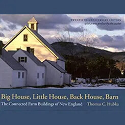
Big House, Little House, Back House, Barn: The Connected Farm Buildings of New England
By Thomas C. Hubka
For Educators. Explores the four components of New England farmhouses and how they reflect rural culture in the 19th century
Journal
The Granite State House
By James L. Garvin and Donna-Belle Garvin
For Educators. A special issue of Historical New Hampshire, this illustrated history of the New Hampshire State House covers the building’s construction and two major additions, as well as its furnishings
Article
“John Stark, Originator of New Hampshire’s State Motto, ‘Live Free or Die’”
By Fred M. Caswell
For Educators. Published in Historical New Hampshire in 1945, just weeks after the legislature officially adopted Stark’s words, this article provides some background about John Stark and his role in penning what is perhaps the most well-known state motto in the United States
Book
A Long, Deep Furrow: Three Centuries of Farming in New England
By Howard S. Russell
For Educators. A comprehensive, almost encyclopedic source on farm life in this region of the country
Article
“The Making of the Carrigain Map of New Hampshire, 1803–1816”
By Frank C. Mevers and Mica B. Stark
For Educators. Published in Historical New Hampshire in 1997, this article traces Philip Carrigain’s long efforts to produce New Hampshire’s first official state map
Book
A New Order of Things: How the Textile Industry Transformed New England
By Paul E. Rivard
For Educators. An overview of the textile industry and the many changes it brought to all aspects of New England
Book
On the Road North of Boston: New Hampshire Taverns and Turnpikes, 1700–1900
By Donna-Belle Garvin and James L. Garvin
For Educators. This richly illustrated and entertaining book reconstructs the physical landscape, the taverns themselves, the network of roads, travel conditions, traffic, and commerce
Book
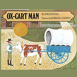
Ox-cart Man
By Donald Hall and Barbara Cooney
For Students. Classic children’s book of a New England farmer taking his goods to market
Journal
The People's State House
By Elizabeth Dubrulle and Wesley G. Balla
For Educators. A special issue of Historical New Hampshire published on the anniversary of the New Hampshire State House, this well-illustrated journal covers how the people of New Hampshire have used the state house, the portraits displayed throughout the building on its walls, and the five statues that stand on its grounds