
NH Giant Traveling Map
The New Hampshire Historical Society coordinates this program that brings a giant floor map of the state into libraries or classrooms and offers kid-friendly geography activities. It’s perfect for active, visual students!
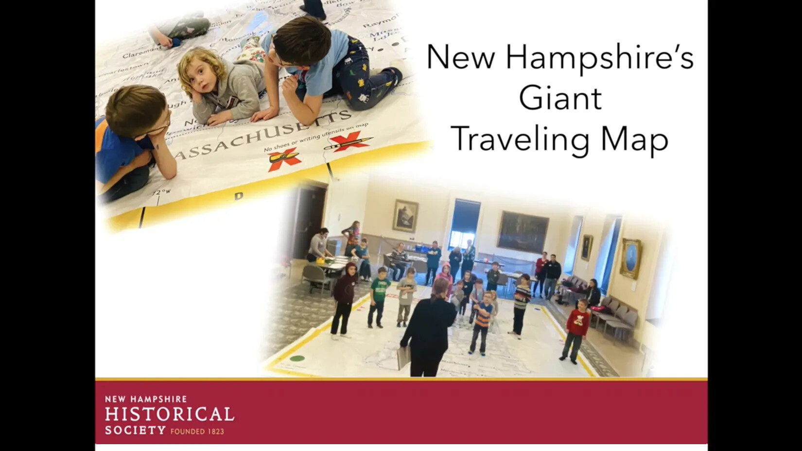
What better way to engage learners in geography, history, science, and math than with a classroom-sized floor map of New Hampshire that they can explore, travel around, and have lots of fun with?
Students get hands-on and feet-on experience in spatial thinking and awareness, practice their geography skills, explore New Hampshire’s natural resources, plan a trip around the Granite State, and much more! The activities developed to use with the map align with state and national standards, and there are many potential connections with “Moose on the Loose.”
New Hampshire's Giant Traveling Map
Learn more about bringing the map to your classroom or library!
The 16’ x 20’ New Hampshire Giant Traveling Map requires a large space to be spread out. The map is made of sturdy vinyl so students can walk on it, stand on it, sit on it, or crawl over it, as long as they are wearing socks. No shoes or bare feet!
How can you get a chance to explore the New Hampshire Giant Traveling Map?
- Family Program! At least once a year, the New Hampshire Historical Society hosts a free family program featuring the Giant Traveling Map. Check the Programs & Events Calendar on the Society’s website to see if one of these programs is scheduled soon.
- Borrow the Map! Educators may borrow the map, with a trunk full of activities, at no charge and set it up in their classrooms or common space, like a library, cafeteria, or gymnasium. It’s perfect for classroom fun, after-school programs, or homeschool groups. Some schools even incorporate the map into school-wide or district-wide family geography nights. For more information about borrowing the Giant Traveling Map, check out the FAQ below and then contact the New Hampshire Historical Society’s Assistant Director of Education Jenn Walton at jwalton@nhhistory.org or 603-856-0645.
- Calling All Homeschoolers! Homeschoolers participating in the New Hampshire Historical Society’s year-long program “Exploring New Hampshire: Granite State History for Homeschoolers” use the Giant Traveling Map in one of their sessions. For more information about this program, see the Homeschool page on the Society’s website.
The New Hampshire Giant Traveling Map is one of two giant maps donated to the New Hampshire Geographic Alliance (NHGA) by National Geographic. On the NHGA’s behalf, the New Hampshire Historical Society is happy to offer this resource to New Hampshire educators.
NH Giant Map FAQs
Find out more about reserving the NH giant map and associated teaching resources
NH Giant Map Host Agreement
Read the fine print on bringing the giant map to your school or group