
Unit 1 Plan: New Hampshire Geography

Unit Summary

In the “New Hampshire Geography” unit, students and educators explore maps, geography skills, and the land of New Hampshire. Geography is a wide-ranging topic but also an essential subject to study as it teaches skills necessary far beyond the classroom. The unit focuses first on upper-elementary vocabulary and map skills, then explores New Hampshire through its weather, land forms, and various boundaries. It engages students by teaching the history of New Hampshire’s land and borders through explainer videos and by having them practicing map-making skills in local areas. The unit provides a unique introduction to geography through the study of New Hampshire’s history, regions, land, and borders.

You're on page

The Big Picture

This natural history unit covers a wide range of topics related to New Hampshire’s physical, geographic history:

  • Although New Hampshire is the fifth smallest state in the country, it contains a remarkable variety of topography, plant and animal life, and climate.

  • When the last ice age ended about 12,000 years ago, New Hampshire was a land of mountain ranges (notably, the White Mountains), rolling hills, hundreds of lakes, and several rivers (particularly the Connecticut and Merrimack Rivers), with a small stretch of rocky ocean shore.

  • Most of New Hampshire is classified as having a cool-temperate climate, although the many areas of the state that are at high elevations, particularly Mount Washington, have more extreme weather conditions. In addition, the range of latitude New Hampshire covers between its northern and southern portions creates two distinct climates for these regions, although all parts of the state experience four distinct seasons.

  • There are six categories of animal and plant habitats that support 500 species of wildlife, not including insects: forests; alpine, rock, cave; lakes, ponds, rivers; grass, shrub, developed land; wetlands; and coastal. Of note is that New Hampshire is the second-most forested state in the country.

  • The region’s geography has affected the way people live in New Hampshire, and the harvesting of natural resources has made a major impact on settlement patterns.

  • New Hampshire is generally thought to have three different types of topography: Coastal Lowlands, Eastern New England Uplands, and the White Mountains. But the people of the state tend to see it divided into seven regions, all with unique geographic and cultural features: Seacoast, Merrimack Valley, Monadnock, Lakes, Dartmouth/Lake Sunapee, White Mountains, and Great North Woods.

  • New Hampshire’s history of map-making illustrates the impact geography has had on the state’s development and history.

Introduction

From its Atlantic coastline, through its dense forests and meandering rivers, across its lakes, and over the peaks of its alpine mountains to its international border with Canada, New Hampshire’s geography is like no other state. Its range of elevation and orientation on the globe combine to create a unique topography and climate that support a remarkable variety of animal and plant life as well as human activity in a relatively small space. New Hampshire is dominated by the rugged White Mountains in the north and cut through by thousands of miles of streams and rivers including the Connecticut River, which runs along its western border with Vermont, and the Merrimack River, which runs north to south through the middle of the state. Covering 9,351 square miles, New Hampshire is the fifth smallest state in the country. In 2020 its population is just over 1.3 million people, who are concentrated in the southern half of the state. The capital is Concord, a small city of 40,000 located on the Merrimack River near New Hampshire’s geographic center.

Exploring the geography of New Hampshire, its “earth writing,” is far more than simply absorbing a collection of facts about the land’s surface and inhabitants, past and present. It is an investigation that goes beyond the “what” and “where” of physical and human characteristics to the “how” and “why” those characteristics came to be. Each unit of this curriculum investigates geographic “how” and “why” questions relevant to particular eras of the state’s history. This unit focuses on how the physical characteristics of the land came to be, the ways in which those features support plant and animal life, why humans have explored the land, and how people have organized their understanding of its features.

Why study New Hampshire’s geography?

Understanding place is an essential part of well-developed geographic knowledge. When students examine New Hampshire’s geography, they can gain an impressive range of geographic knowledge merely by studying the diversity of their own home state. The variety of the topography combined with its long history make New Hampshire’s geography a story well worth exploring.

Physical Characteristics

What gave the land of New Hampshire its features?

The oldest layers of bedrock in New Hampshire date back 650 million years. Hundreds of millions of years of upheaval deep within the earth and glacial erosion on the earth’s surface created the shape of the land, cut through with rivers, rolling with forested hills and mountains, and dotted with lakes. Faults, folds, and even volcanic activity pushed up chains of mountain ridges. Within many of these hills and mountains were huge quantities of granite that would become essential to New Hampshire’s economy and identity.

Beginning about 2 million years ago, four periods of glaciation covered the land with enormous glaciers, the ice so heavy that it shaved off the tops of mountains and cut beds and depressions for the thousands of miles of lakes, rivers, and streams that cover New Hampshire today. As the glaciers melted, they eroded the bedrock, cutting cliffs and ravines, and leaving behind the till—a mix of giant boulders, stones, gravel, silt, and clay— that would cover most of New Hampshire’s surface. The melting glaciers caused the sea level to rise, bringing floods that left major soil deposits along the coast.

When the last glacier melted, about 12,000 years ago, it left behind the craggy White Mountains, part of the northern Appalachian Range and still New Hampshire’s dominant topographical feature. Southward, the land sloped into drumlins, which are smooth whale-back shaped hills formed by compressed glacial till. In the southwest, erosion isolated a gigantic peak that would later be named Mount Monadnock. Deep glacial lakes, the largest of which being Lake Winnipesaukee, dotted the land. Some glacial lakes became the rivers that drain the land, including the Merrimack and Connecticut Rivers. On the east coast, sections of rocky shore alternated with crescent-shaped sandy beaches protected by huge dunes. The land called New Hampshire ranged from sea level to an elevation of 6,288 feet at the top of Mount Washington, which stretches more than a mile into the sky. This range of elevation, the greatest of any state or province in northeastern North America, would determine nearly everything about who and what would live in New Hampshire.

Climate

How does the geography of New Hampshire impact its weather?

The melting of the glaciers brought about a change in the climate, meaning the weather conditions prevailing in an area over a long period of time. Warmer weather meant plants and animals could grow and thrive. Today, New Hampshire is generally classified as having a cool-temperate climate. However, New Hampshire can never be a uniformly temperate place due to the change of elevation within the state. Although much of the state may be classified as having a cool-temperate climate, the climate at the top of Mount Washington is roughly equivalent to that of Iceland. Wind speed increases as it travels up and over mountains, and air masses cool at higher elevations and create precipitation—hence the heavy snowfall in New Hampshire’s mountainous regions and a record 231-mile-per-hour wind documented at the top of Mount Washington. Even within areas that seem to have the same climate there are variations; depressions and ravines impact how much sunlight can reach the nooks and crannies of the land. Ice Gulch in Randolph, for example, often has ice until August.

Geospatially, New Hampshire as it is defined today spans two-and-a-half degrees of latitude, which creates distinct climates in its northern and southern halves. The vertical shape and position of New Hampshire, reaching from the Atlantic Ocean to the border with Canada, make it susceptible to storms that travel up the Atlantic coast. Blizzards, nor’easters, hurricanes, and even tornadoes have all made landfall in New Hampshire. While it has four distinct seasons, spring is more of a brief “mud season” between a long winter and a humid summer. Autumn in New Hampshire is brisk, the stark drop in temperature creating a leaf color so vibrant that millions of people travel to the state to “peep” at the fall foliage.

Features of the Land: Habitats and Species

How does the geography of New Hampshire support plant and animal life?

New Hampshire’s wide topographical and geospatial ranges support a variety of climate zones and habitats where different plants and animals are able to live. Features of New Hampshire’s land provide 27 unique habitats for 500 species of wildlife, not including the ubiquitous insects. The New Hampshire Fish and Game Department divides these into the following six categories:

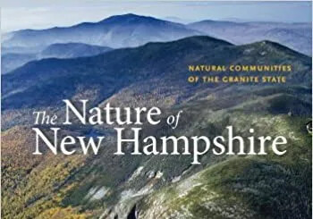
Forests: Eighty percent of New Hampshire is covered by forest, making it the second most forested state in the country, behind Maine. This dense forest cover represents a massive reforesting of the state, as 250 years ago much of New Hampshire’s forest had been cleared for farms and pastureland. Even the state’s mountains were deforested in the late 1800s and early 1900s when the logging industry boomed. These changes in land cover have also changed the plant and animal species that live and grow in forest areas. Much of the state is covered by forests of hemlock, white pine, beech, and oak trees. Forests of spruce and fir, as well as mixes of beech, sugar maple, yellow birch, and eastern hemlock, are found at elevations ranging from 1,000 to 3,500 feet above sea level. At elevations below 900 feet, forests usually feature oak, hickory, and sugar maple. Many birds and mammals make their homes in New Hampshire’s forests including black bears, lynx, moose, bats, scarlet tanagers, purple finches, eagles, turtles, snakes, salamanders, and toads.

Alpine, Rock, and Cave: Above the tree line, which occurs at about 4,900 feet, New Hampshire’s peaks feature an alpine habitat of low temperatures, high winds, and precipitation. In fact, the Presidential Range contains 12 square miles of alpine tundra. Bigelow’s sedge grows in this unique environment, which is also home to the American pipit, a bird that breeds in alpine habitats, and the artic butterfly. Rocky ridges, cliffs (such as the historic Old Man of the Mountain), and masses of rock debris called talus slopes provide homes throughout the state to bobcats, timber rattlesnakes, and golden eagles. While some caves, such as the Polar Caves in Rumney, are due to glacial movement, others are human-made.

Lakes, Ponds, and Rivers: The thousands of cold-water and warmwater lakes, ponds, rivers, and streams across New Hampshire support a huge array of aquatic life. Typically, bodies of water with cold-water habitats occur in the northern part of the state or at higher elevations and support fish like brook trout, lake trout, and burbot. The common loon also makes its home around these types of bodies of water. Warmwater rivers include the Merrimack and Connecticut, downstream of the Upper Ammonoosuc, and support fish like shad and sturgeon. At the time Europeans arrived in New Hampshire in the early 17th century, the fish in the Merrimack were said to be so plentiful that a man could practically walk across the river on them. Bald eagles depend on the aquatic life of New Hampshire’s rivers for food.

Grass, Shrub, and Developed Land: Grasslands feature sedges, grasses, wildflowers, and few shrubs or trees. As the amount of forest has increased in the state, the amount of grassland has decreased. Farm and pastureland used to provide a great deal of the grassland habitat in New Hampshire. Species including bumblebees, meadowlarks, turtles, and upland sandpipers live in New Hampshire’s grasslands. Animals like the New England cottontail rabbit and the woodcock need the increased cover provided by shrublands. Interestingly, human-made structures in developed land, like multistory buildings, often simulate some of the features of natural formations like the cliffs that peregrine falcons and swifts depend on for finding food and shelter. Many bees have turned to orchards and nurseries for access to flowering plants.

Wetlands: Swamps, peatlands, floodplains, and vernal pools are all examples of wetland habitat that occur in New Hampshire. Swamps, which in New Hampshire are essentially forested areas with poor drainage, provide habitats for shrews, salamanders, and bats. Peatlands, which feature low-nutrient, high-acidity water, support white cedar, sphagnum moss, and bog lemmings. Floodplains occur in valleys adjacent to rivers. Many animals use these areas as habitat, including beaver, mink, and otter. Vernal pools, which occur seasonally in the spring, are found within nearly all other habitat types.

Coastal: The 18 miles of New Hampshire’s coastline along the Atlantic Ocean offer habitats in the forms of islands, dunes, estuaries, salt marshes, and of course, the ocean itself. Four of the nine Isles of Shoals—so named by early colonists because of the schools, or shoals, of fish that lived in abundance in the surrounding waters—belong to New Hampshire. The islands feature rocky outcrops and shrubby grasses. Seavey and White islands provide habitats for endangered terns as well as seals, barnacles, and monarch butterflies. While the giant inland dunes pushed up by the end of the last ice age have disappeared, coastal sand dunes remain important habitats for bird species like the piping plover. Where rivers meet the sea, estuaries are formed. In these special habitats, eelgrass beds, oyster reefs, and mudflats provide an abundance of nutrients for a wide range of species including horseshoe crabs, herring, and shad. Osprey, among other water birds, feed here. Similarly, salt marshes provide a nutrient-rich combination of land and water that supports many bird species. These tidal wetlands also provide protection from storm surges, though roughly 30 to 50 percent of New Hampshire’s original salt marsh has been lost to development. In the strictly aquatic habitat of the ocean, striped bass, mackerel, and bluefish swim in the waters near the shore. Atlantic cod, lobster, and harbor porpoises also live in the waters near New Hampshire.

Regions and Boundaries of New Hampshire

How does the geography of New Hampshire support human activity?

Just as the plants and animals of New Hampshire live around the state according to where they can find food and shelter, so have people made use of the land and its resources. Abenaki moved seasonally around a vast territory that includes present-day Vermont, New Hampshire, Maine, and part of Canada. Sub-tribes, such as the Penacook, Nashua, Ossipee, and Winnipesauke had distinct territories in what is present-day New Hampshire; many of the place names still used today are reminders of those territories.

Europeans initially made use of the land and resources by the coast, the first part of New Hampshire they were able to access. Fishing as a way to survive in the area was followed by farming as settlements grew and people moved north and west to establish towns in river valleys. The forests were cleared to make room for farms, but throughout New Hampshire timber proved a significant resource, not only for building the colony but also for building the tall masts for the ships of the British navy and, later, for producing paper. The many rivers of New Hampshire, which fed fertile farmland and offered a means of transporting timber, later provided the power for industrialization, which changed the shape of the land and transformed small communities into cities surrounded by suburbs.

With English settlement in the 17th and 18th centuries came the practice of creating towns and, eventually, counties. Town and county lines changed many times during the nearly four centuries that New Hampshire has been a colony and a state. The original four townships of Dover, Exeter, Hampton, and Strawbery Banke (present-day Portsmouth) have grown to 221 towns, 13 cities, and 22 unincorporated places. The five original counties created in 1769 (Cheshire, Grafton, Hillsborough, Rockingham, and Strafford) were divided and redrawn over the next eight decades to include Coos (1805), Merrimack (1823), Sullivan (1827), Belknap, and Carroll (both in 1841).

Establishing the colonial and state boundaries of New Hampshire were also decades-long efforts ripe with political intrigue and maneuvering. Of particular note was an unfortunate 17th-century misunderstanding about the direction of the Merrimack River, Vermont’s 1781 attempt to annex part of Cheshire County, and the existence in the early 19th century of an independent nation called the Indian Stream Republic that encompassed the present-day town of Pittsburg. All three of these episodes are covered in more detail in their respective units.

Today, it is far more common to refer to parts of the state using geographical, rather than political, boundaries. Some geographers define New Hampshire as having three distinct geographic regions: Coastal Lowlands, Eastern New England Upland, and the White Mountains. However, those living within New Hampshire are more likely to refer to one of seven widely recognized geographic regions. Each of these regions is defined by its dominant physical characteristics, which in turn affect the human activity in each region.

Seacoast Region: The smallest of the seven regions, the Seacoast contains all of New Hampshire’s towns along the Atlantic coastline and stretches from the Isles of Shoals, 10 miles off the coast, inland to Sandown at its western extreme. This was the area first settled by Europeans, beginning with seasonal fishing camps on the Isles of Shoals. Portsmouth, with its deep harbor, has a long history of water-related industry, extending from colonial shipbuilding to the Pease Development Authority.

Merrimack Valley Region: Located just to the west of the Seacoast, the Merrimack Valley contains three of New Hampshire’s largest urban areas—Nashua, Concord, and Manchester (New Hampshire’s largest city)—all of which grew because of agriculture and industry along the Merrimack River. The powerful Amoskeag Falls on the Merrimack River, recognized as one of the most powerful waterfalls in New England, was an important fishing ground for the Abenaki and later provided the power for what would become the largest textile mill in the world. This region is home to 30 percent of the state’s population.

Monadnock Region: Containing 40 towns in the southwestern corner of New Hampshire, the Monadnock Region takes its name from the striking landform created by glacial erosion: an isolated 3,165 ft mountain. One of the most frequently climbed mountains in the world, Mount Monadnock is surrounded by small towns and rolling farmland nourished by the Connecticut River.

Lakes Region: North of the Merrimack Valley, the Lakes Region is home to Lake Winnipesaukee, which covers nearly 72 square miles, making it New Hampshire’s largest lake. The towns around the lake, including Wolfeboro, one of America’s oldest resort towns, were shaped by tourism to Lake Winnipesaukee and the 250 other lakes and ponds in the region.

Dartmouth/Lake Sunapee Region: Named for both a major body of water and an educational institution, this region runs along the Connecticut River, New Hampshire’s border with Vermont. Beginning in 1796, bridges were built across the river to connect one of the region’s towns, Cornish, with the neighboring town of Windsor, Vermont. All were washed away by floods until 1866 when construction of a remarkably long covered bridge was completed. The Cornish-Windsor bridge—measuring 450 feet, the longest of its kind in the world—still spans the river today.

White Mountains Region: Containing New Hampshire’s most notable topographic feature, the peaks of the White Mountain Region have challenged humans to test their mettle against the elements for centuries. Of the 48 mountains in New Hampshire that climb to over 4,000 feet in elevation, 46 are in this region. In 1869, inventor Sylvester Marsh used new technology to tackle Mount Washington when his Cog Railway began transporting visitors to the top of the mountain. The region’s snow-covered slopes also encouraged Scandinavian immigrants to introduce their traditional sports of alpine and Nordic skiing to the United States in the late 19th and early 20th centuries. The White Mountain National Forest was established in 1918 as part of an effort to limit the detrimental environmental impact of logging.

Great North Woods: Also called the North Country, the northernmost reaches of New Hampshire are most densely populated with trees, less so with people. This region supplied the timber for the great logging and paper industries that shaped New Hampshire’s economy in the late 19th and early 20th centuries. The proximity to the province of Quebec has resulted in a long history of cross-cultural exchange with French-Canadians. The 45th Parallel, New Hampshire’s northern line of latitude, runs right through this section of the state and is marked on a major roadway, Route 3, so it is possible to stand there and be exactly halfway between the equator and the North Pole.

Exploring and "Writing" the Land

How have people organized and documented their understanding of New Hampshire’s geography?

Information about what New Hampshire looks like is the result of human exploration of its shape, features, and resources. This exploration began long ago, when the melting of the last glacier 12,000 years ago made it possible for people to inhabit New Hampshire. When European explorers in the early 17th century found their way to the New England coast, they created maps of the land and water they encountered. Bartholomew Gosnold’s 1602 map of New England, from Maine south to Narragansett Bay in Rhode Island, became a valuable reference for the explorers who came next. English sailor Martin Pring led an expedition in 1603 in search of sassafras, to be used for its medicinal qualities, and sailed into the Piscataqua River. Though the sassafras was not found in New Hampshire, Pring’s written account of his journey was circulated widely and became important evidence of Britain’s claim on this part of the New World.

Indeed, the many, many maps that have been created of New Hampshire’s features have had purposes far more complicated than showing locations and supporting wayfinding. They have been documents of ownership, change, and movement of people and industry. The work involved in creating maps has changed in significant ways since those early explorers made landfall. The surveyors of the 18th century, first working to define the boundaries and contents of England’s colony, explored New Hampshire on foot and horseback, with simple tools like compasses, tripods, and chains. They were often joined by teams of men who needed to clear the land in order to provide enough open space to stretch the 66-foot-long chains in relatively straight lines. The varied topography of New Hampshire makes it all the more extraordinary that these maps were completed with relatively few errors. Today, cartographers can get the whole picture of New Hampshire by compiling data from satellite images. Digital maps that meet a variety of needs and purposes can be amended, layered, and customized at a rate that would have astounded New Hampshire’s early cartographers, like Philip Carrigain, whose 1816 map of New Hampshire—the first complete map of the state—took 13 years to create.

Even those who are not creating maps but merely exploring can traverse the land called New Hampshire at a far greater speed than ever before. People started traveling the state over small dirt paths and turnpikes, the “corduroy roads” of logs laid over muddy rocky stretches, the mast roads created to move the enormous white pine trunks from forest to river, and the treacherous passes through the notches of the White Mountains. These were then augmented by far-reaching railroad tracks and, later, the network of highways and interstates that crisscross New Hampshire today, many of which follow in the path of those early, more primitive roads.

Focus Questions for This Unit

Lessons in this unit are geared towards students answering the unit focus questions comprehensively through a variety of methods. This unit’s focus questions are:
  • 1
    What physical and human characteristics define New Hampshire?
  • 2
    How did New Hampshire's boundaries and regions come to be the way they are today?
  • 3
    How has the way people explored and represented New Hampshire changed over time?
  • 4
    How does where you live impact how you live?

Essential Questions for This Unit

Essential questions are designed to be answered repeatedly throughout the entire curriculum. This unit particularly addresses two of the curriculum’s essential questions:
  • 1
    How has New Hampshire come to be the way it is?
  • 2
    How has New Hampshire been shaped by many voices?

In the “New Hampshire Geography” unit, two lessons start with basic map skills and vocabulary, and examine where New Hampshire is in the world. Three lessons then focus on the types of land in New Hampshire, its weather, and its seven geographical (tourist) regions. Two additional lessons focus on traditional map-making skills and how New Hampshire’s borders came to be. In the summative assessment lesson, students use unit knowledge to examine their town’s geography and add a layer of data to a town map.

Lesson Plan 1: Map Vocabulary and Introduction

Students play a variety of vocabulary games with map vocabulary and use Moose’s Encounter, Investigate, and Build sequence to learn basic map skills.

Lesson Plan 2: New Hampshire in the World

Students brainstorm where they are in the world before using Google Earth screen shots to envision New Hampshire’s location and human and physical features.

Lesson Plan 3: New Hampshire's Land

Students use an experiment and an explainer video to understand how glaciers affected New Hampshire’s land, then engage with a topographical map and postcards of New Hampshire to visualize the land.

Lesson Plan 4: New Hampshire's Weather

After investigating different kinds of extreme weather in New Hampshire, students work in small groups to create a meteorologist report about one kind of extreme weather.

Lesson Plan 5: Regions of New Hampshire

Students sort manmade and natural attractions in New Hampshire by region, then plan a trip through all seven regions.

Lesson Plan 6: New Hampshire's Borders

After an activity investigating the effect of boundaries and their connections to the surrounding physical space, students analyze the physical and political shape of the state with 1799 and modern-day maps.

Lesson Plan 7: Mapping New Hampshire

Students use primary sources to learn about how traditional map making was done, before they make their own tools to measure the classroom in a manner similar to that used by the early surveyors of New Hampshire.

Lesson Plan 8: Mapping Your Town

Students take unit knowledge and apply it to local areas by choosing an aspect of their town that interests them and creating a map or adding layers to an existing map.

Please note that a printable vocabulary list with definitions is accessible to students in the Learn It! section of this unit.

Vocabulary in This Unit

absolute location (noun) The exact location of a place on Earth determined by the intersection of longitude and latitude measurements
blizzard (noun) A long severe snowstorm
border (noun) A real or imaginary line that divides two places. Usually a human feature; also called a boundary
cardinal direction (noun) One of the four main directions featured on a compass rose: north, south, east, and west
climate (noun) The typical weather conditions, such as temperature and precipitation, in a specific area
climate change (noun) Changes in Earth's average temperatures, which influence all plant and animal life on the planet
compass (noun) A tool used to determine directions by following a metal needle drawn toward magnetic north
compass rose (noun) A symbol that represents a compass showing cardinal and intermediate directions
continents (noun) The seven large land masses on Earth: Antarctica, Asia, Africa, North America, South America, Europe, and Australia
county (noun) A section of a state with defined boundaries and its own governmental services. New Hampshire has ten counties.
deciduous (adjective) A type of tree that loses its leaves in the fall and grows them back in the spring
dune (noun) A hill of sand created by wind that provides protection from the ocean and a habitat for coastal plants and animals
elevation (noun) The height of land measured from the level of the sea
equator (noun) The imaginary line that runs east-west around the middle of Earth and represents zero degrees latitude
estuary (noun) A body of water where a river meets saltwater
flood (noun) A rising and overflowing of a body of water especially onto normally dry land
geography (noun) The study of the physical, biological, and cultural features of Earth’s surface
glaciers (noun) Large masses of ice that also contain dirt, rocks, and other debris, which form during ice ages
global warming (noun) The increase of the average temperature on Earth
granite (noun) A hard rock naturally occurring in New Hampshire and used particularly for buildings and monument
Gunter chain (noun) A tool used by surveyors, this chain of 100 equal links is 66 feet in length and is stretched across the land to calculate distances
habitat (noun) A place where a plant or animal typically lives and grows
hemisphere (noun) One half of Earth; the northern and southern ones are split by the equator and the eastern and western ones are split by the prime meridian
human feature (noun) An element added to Earth’s surface by people, usually to provide shelter, create borders, or support transportation
hurricane (noun) Violent tropical cyclonic storm having wind speeds of at least 72 miles per hour
ice age (noun) A long period of time when the average temperature on Earth drops a great deal and much of the planet becomes covered in snow and ice that form glaciers
ice storm (noun) A storm in which falling rain freezes on contact
intermediate direction (noun) A point between two of the main points on a compass: northwest, southwest, northeast, and southeast
key (noun) An explanation of abbreviations or symbols used on a map, sometimes called a legend
latitude (noun) The distance north or south of the equator, measured in degrees, represented by invisible parallel lines running east to west around Earth
longitude (noun) The distance east or west of the prime meridian, measured in degrees represented by invisible parallel lines running north to south around Earth
meteorology (noun) A science that deals with the atmosphere and its occurrences and especially with weather and weather forecasting
mudslides (noun) The collapse of hillsides or mountainsides producing a river of mud, rocks, trees, and debris; usually caused by too much rainfall
natural resources (noun) Elements found in nature that are used by people including light, air, soil, plants, animals, rocks and minerals, and fossil fuels
nor'easter (noun) A large storm along the east coast of the United States, with winds coming from the northeast, occurring most often between September and April
oceans (noun) The five large bodies of water on earth: Arctic, Atlantic, Indian, Pacific, and Southern
physical feature (noun) A naturally occurring feature on Earth’s surface such as a landform or body of water
prime meridian (noun) The imaginary line that runs north-south around the middle of Earth and represents zero degrees longitude
quarry (noun) A deep pit created by humans in order to dig up certain types of stones or other materials like gravel or sand
region (noun) A section of a state or country that has specific characteristics but does not have an official boundary
relative location (noun) The location of a physical or human feature described with cardinal and intermediate directions from another physical or human feature
renewable resource (noun) Any material, such as wood or solar energy, that can or will be replenished naturally in the course of time
rural (adj) An area of land that is primarily used for farming, where there are no large towns or cities
scale (noun) A tool, printed or drawn, to show how distances should be measured on a map
summit (noun) The highest point of a mountain or hill
surveyor (noun) A person who takes measurements of the land in order to determine boundaries or provide data for a map of an area
urban (adj) A large town or city, where there are lots of buildings and people
watershed (noun) An area of land that drains into a particular river
wetlands (noun) Areas of land that do not drain well such as swamps, marshes, and bogs


Go See It!
Field trips about "New Hampshire Geography," suggested by the "Moose on the Loose" team.
Website
“New Hampshire: Get Facts and Photos about the 9th State”
By Jaime Kiffel-Alcheh for National Geographic Kids
For Students. Accessible facts about the Granite State.
Website
“Map Skills for Elementary Students”
By National Geographic
For Educators. Collection of lesson plans about spatial reasoning organized by grade level.
Website
“Habitat Types and Species”
By New Hampshire Fish and Game
For Educators. Extensive information about New Hampshire habitat types and species
Website
“DNCR State Lands Viewer”
By NH Dept. of Cultural Resources and NH Fish and Game
For Educators. NH Division of Forests and Lands interactive topographical map that highlights conservation land
Website
“Forests and Lands Maps”
By NH Division of Forests and Lands
For Educators. New Hampshire Division of Forests and Lands’ maps of individual state forests and parks.
Website
“Mount Washington Observatory”
By Mount Washington Observatory
For Students and Educators. Mount Washington observatory weather archive, photographs, and live webcam feed.
Website
“Resources for Teachers: Grade 3–5”
By U.S. Geological Survey
For Educators. U.S. Geological Survey resources for grades 3–5 including lesson plans, multimedia, and background information.
Website
“Why Do Autumn Leaves Change Color?”
By Mark Fischetti for Scientific American.
For Students and Educators. Scientific American editor Mark Fischetti explains how the leaves of deciduous trees perform their annual chameleon act, changing from various shades of green to hues of bronze, orange, and brilliant red.
Website
“Rocky Shore Curriculum”
By Thom Smith for the Seacoast Science Center
For Educators. The “Rocky Shore Curriculum” is a free online science curriculum for grades 3–5. This curriculum is aligned to both the Next Generation Science Standards and the Ocean Literacy Principles.
Book
The Nature of New Hampshire: Natural Communities of the Granite State
By Dan Sperduto and Ben Kimball
For Educators. Visual book explores the landscapes and natural communities of New Hampshire’s plants and animals.
Book
Weather Facts and Fun: New England Edition
By Josh Judge and Kathe Cussen
For Students. Written by a meteorologist and science teacher team and includes local weather, from cloud types to tornadoes and blizzards, as well as experiments, forecasting tools, and maps.
Podcast
By Degrees: Covering Climate Change
New Hampshire Public Radio
For Educators. From NHPR, By Degrees is a climate change reporting project that begins in this historic moment. NHPR tell stories of the challenges and solutions that these intersecting crises are bringing to light—individual stories of resilience and struggle, innovation and compromise, and of big change by degrees. The coverage answers your questions, takes you to new places, challenges those in power, and explores how our state and region are living through climate change—and responding to it.