Secret Found...
Color Mason The Moose!
CLOSE


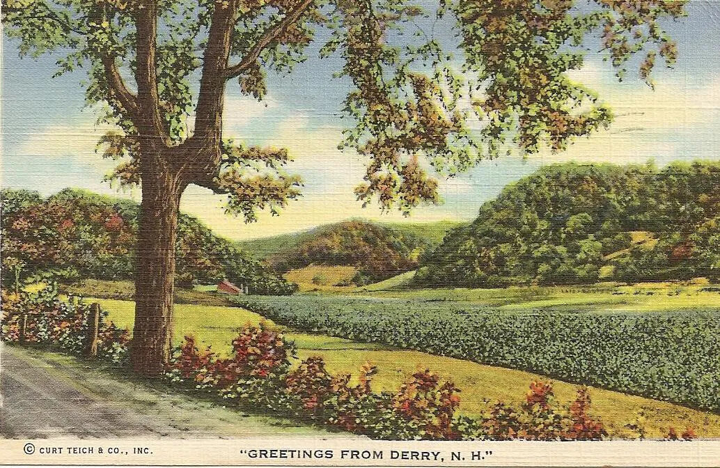
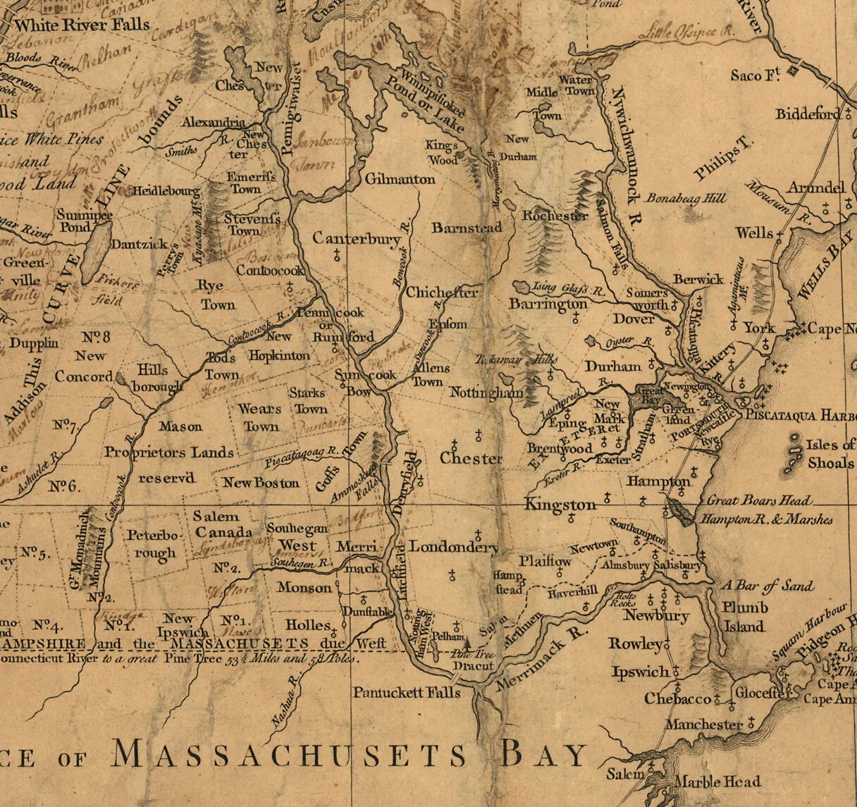
What was New Hampshire like 300 years ago? New Hampshire was a British colony at that time. In fact, it was one of several British colonies in North America that were located along the east coast. The English settlers who had arrived in New Hampshire by 1720 all lived in the southeast corner of New Hampshire, near the seacoast. The biggest settlement in New Hampshire was Portsmouth, which was the colony’s capital.
In 1720, New Hampshire had miles and miles of forests, lakes, and rivers where hardly anyone lived. But New Hampshire was just about to grow a lot bigger. Thousands of people came to New Hampshire in the 18th century, and they settled new towns all over the colony. Most of those towns still exist today.
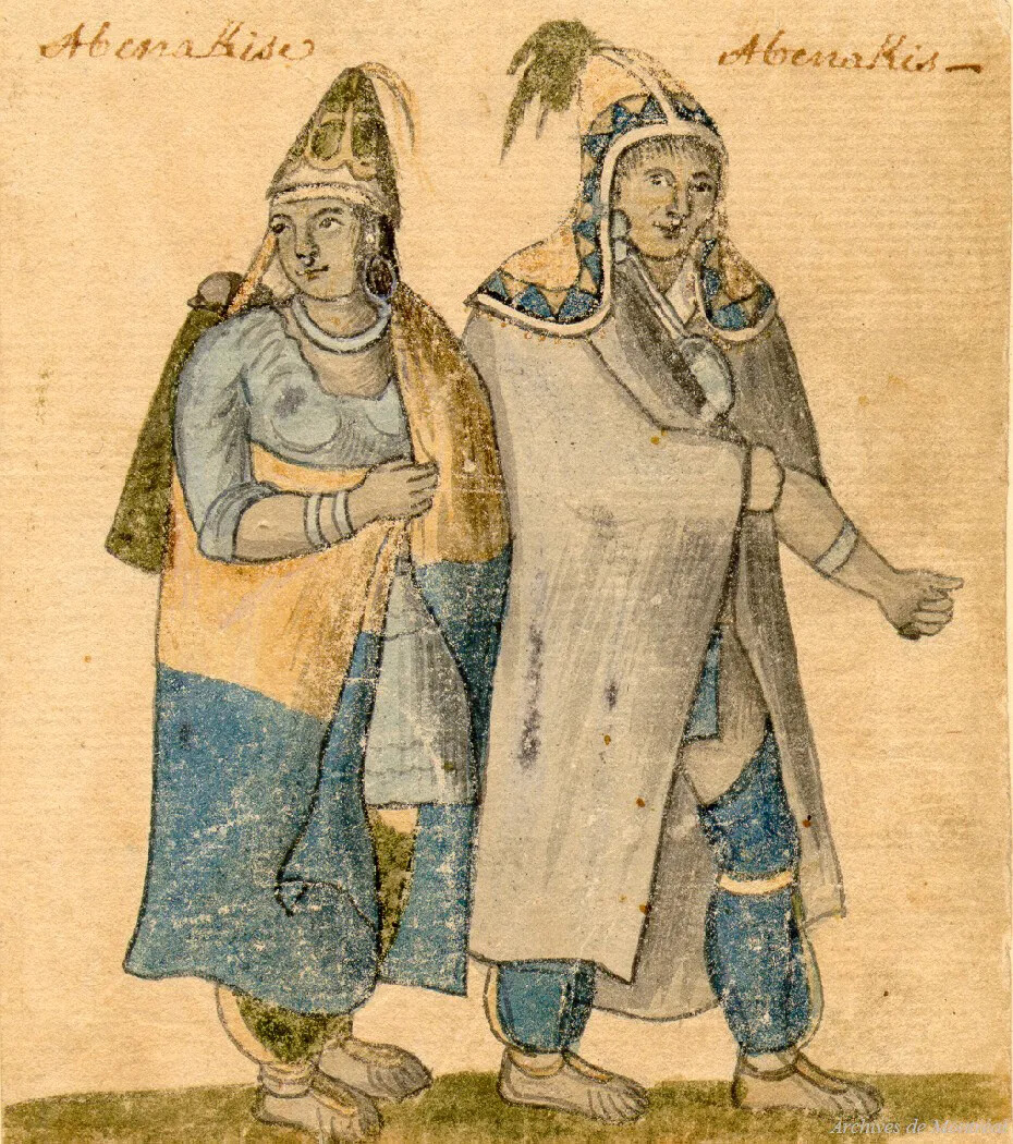
As New Hampshire’s population grew larger, it became more diverse. People from different cultures and different countries came here to settle and build new lives. They joined the Abenaki, who had lived in New Hampshire for thousands of years, and the English settlers who came in the 1600s and early 1700s.
As you learn about New Hampshire in this period, think about the following questions:
How did Portsmouth become the capital of New Hampshire in the 18th century?
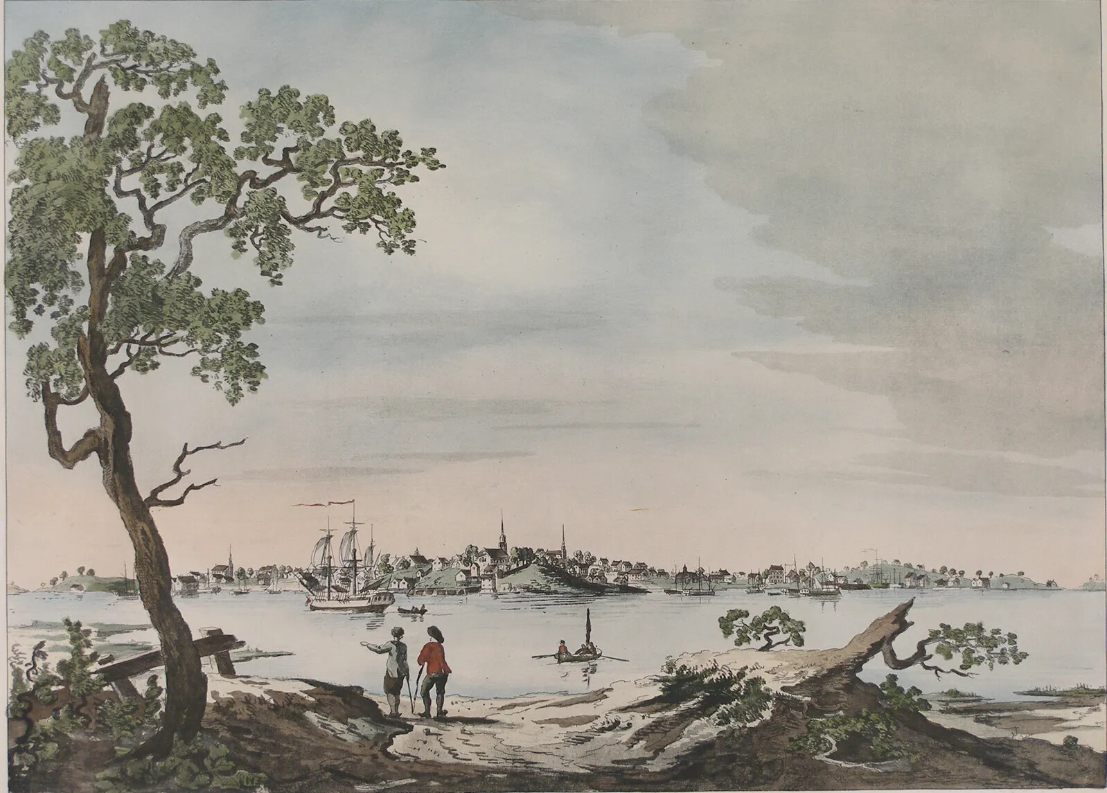
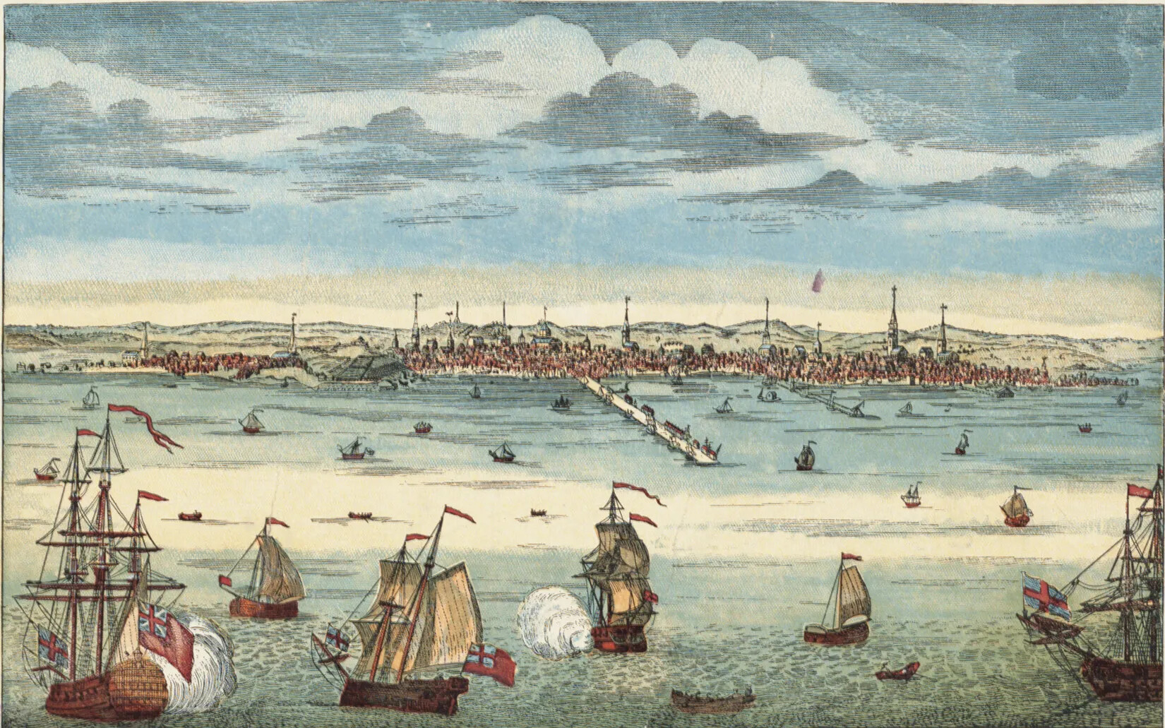
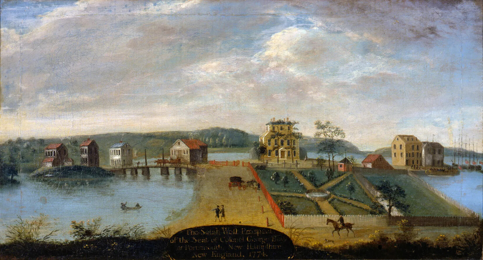
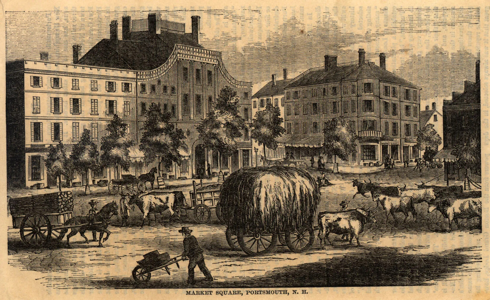
Portsmouth was the largest settlement in New Hampshire during the colonial period. It is located on the seacoast near the border with Maine. Portsmouth has a deep harbor, and it lies at the mouth of the Piscataquog River.
In 1720, more than 1,000 people lived in Portsmouth, most of them in houses that were close together. There were lots of streets in Portsmouth, and in the center of the town was a meeting place called Market Square. Portsmouth had many shops where goods like clothing and household items were sold. There were taverns and inns for the travelers who came to Portsmouth.
There was also a busy dockyard with lots of ships that sailed to other American ports and to Europe, Africa, and the West Indies. Near the dockyard were warehouses that stored things to be shipped someplace else or to be moved further inland to other towns and communities in New Hampshire.
Portsmouth was a busy place during the 18th century, with lots of people coming and going.
How did Portsmouth trade goods with other parts of the world?
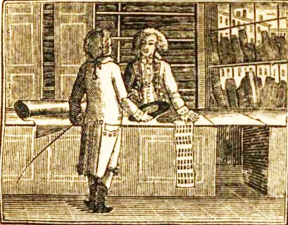
Many of the people who lived in Portsmouth were merchants. They bought natural resources from people living further inland and then shipped those items to people living in other places where they needed those natural resources. This exchange of goods is called trade.
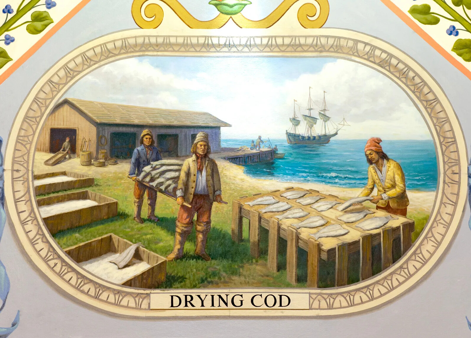
Some merchants traded with people in other parts of America, like Boston or New York. Other merchants traded with people who lived far away in Europe, Africa, or the West Indies. During the colonial period, New Hampshire had three important natural resources that people in other places wanted to buy: fish, fur, and forests.
The fish came from the ocean. There were millions of fish living in the Atlantic Ocean off the coast of New Hampshire. Fishermen caught them using giant nets. Once they brought the fish onshore, the fishermen dried the fish in the sun so they wouldn’t become rotten. This process preserved the fish. After the fish were preserved, merchants sent the fish to Europe, where they fed millions of people.
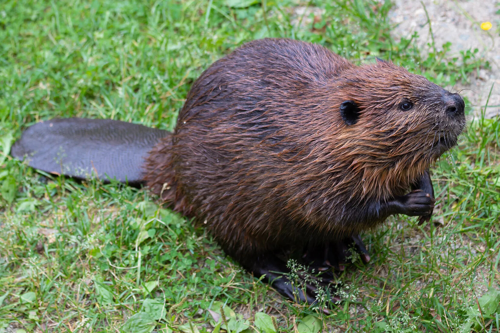
The fur came from beavers who once lived all over New Hampshire. Beavers have beautiful, soft fur that keeps them warm in winter. Wearing beaver fur or pelts became very popular in Europe in the 1600s and 1700s. Trappers in New Hampshire caught beavers for their fur and then sold the fur to merchants. Merchants shipped the fur to Europe where people used it to make hats and coats. New Hampshire once had millions of beavers, but the trappers caught so many of them that beavers almost disappeared from the area.
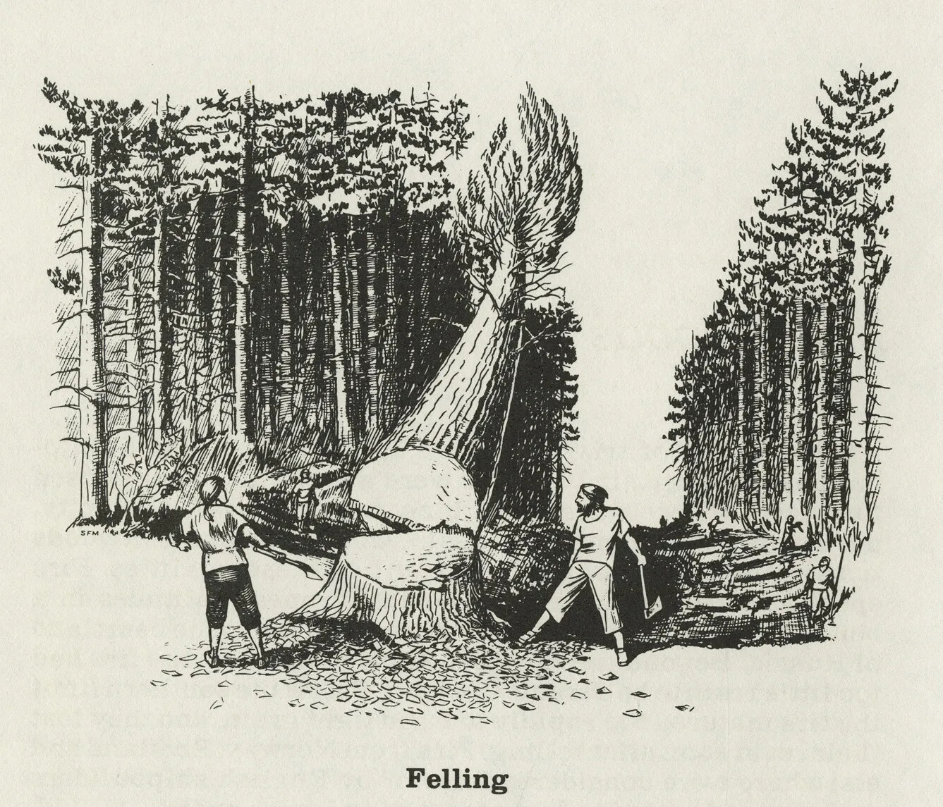
The forests came from the thousands of trees that were in New Hampshire. Lumbermen cut down many of these trees, chopped them into timber, and then shipped the timber to other parts of America and to Europe. People used the wood to build houses and barns, to make things like barrels, boxes, and wagons, and to burn in their fireplaces to help cook food and keep warm.
The British government kept the tallest trees in New Hampshire to use as masts for ships in the navy. Masts hold up the sails on big ships. As the British navy built more ships, they needed lots of mast trees. New Hampshire’s tall white pines supplied many mast trees to the British navy in the 18th century. Almost all of the tall white pine trees were cut down in New Hampshire during this period.
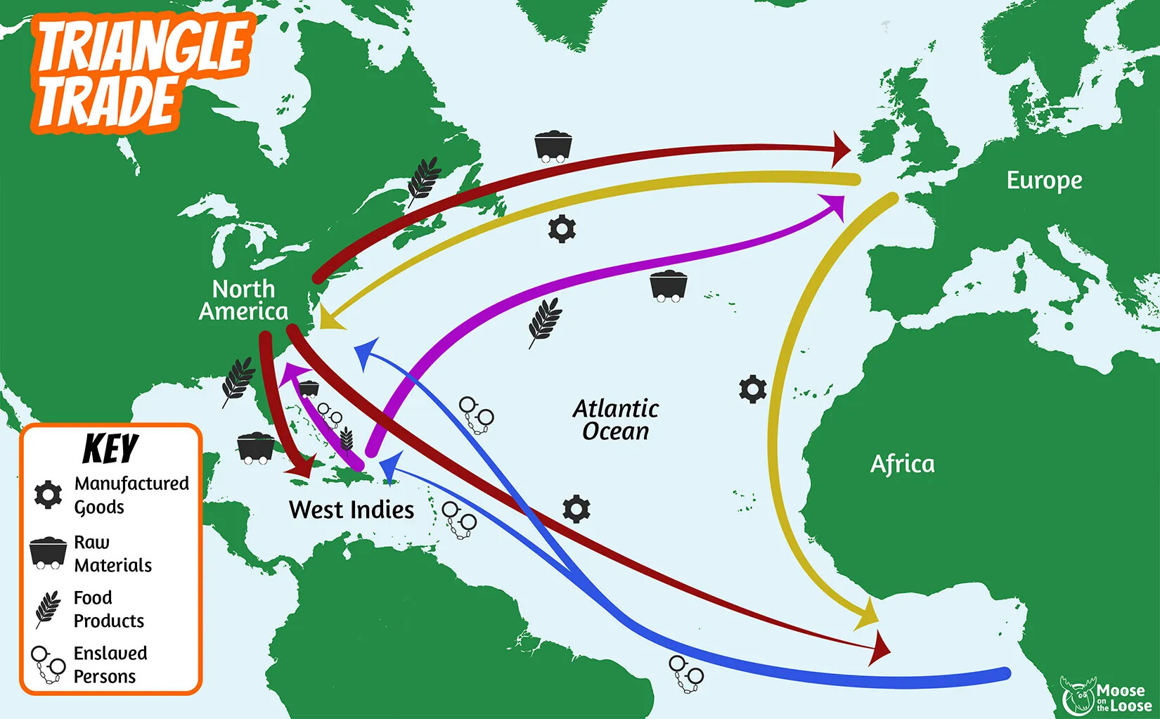
Portsmouth merchants filled their ships with these three products and then sailed to other places to sell them. They sold most of their goods in Europe, especially in Great Britain since New Hampshire was a British colony. Once the merchants sold all their goods, they bought other goods to bring back home to New Hampshire. They often brought back things made in factories, like cloth or household items.
Sometimes Portsmouth merchants sailed to other parts of the world to get different kinds of goods. In places like the West Indies, merchants bought sugar, which was very popular in New Hampshire. People needed it to make their food taste better.
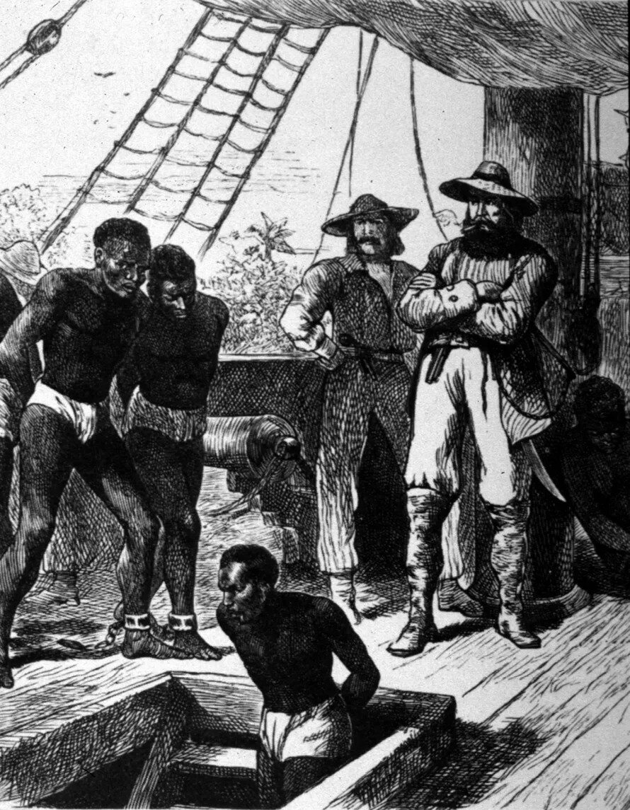
Other Portsmouth ships sailed to Africa, where merchants bought enslaved people and transported them across the Atlantic Ocean to sell them in America. This kind of trade was called the slave trade, and it brought millions of Africans to the American colonies who were sold into slavery. Many people did not like the slave trade, and some merchants refused to buy and sell people. But lots of merchants in New Hampshire and elsewhere were willing to participate in the slave trade because it made them a lot of money.
This trading between North America, Europe, and Africa became known as the Triangle Trade because it involved an exchange of goods between three different continents.
Many people worked as servants in the merchants’ big houses. They cleaned the house, did the laundry, sewed clothing, chopped firewood, cooked meals, and took care of the horses and other animals, like chickens.
Not many people in Portsmouth were farmers, though. Farmers from other parts of New Hampshire brought their goods to Portsmouth and sold them in the marketplace or in stores. Most people in Portsmouth bought their food instead of growing it themselves.
What was life like for Black people in New Hampshire during the colonial period?
Not everyone who lived in New Hampshire during these years was English. New Hampshire’s indigenous people, known as the Abenaki, also lived here. They had once lived all over New Hampshire, but in the late 1600s most Abenaki moved north, closer to the White Mountains and the border with Canada. The Abenaki often came to southern New Hampshire to trade with the English settlers.
More enslaved people were brought to New Hampshire in the late 1600s and early 1700s. Most of them lived in Portsmouth, and they worked in all kinds of jobs. Some helped build ships; others were blacksmiths or carpenters. Most enslaved people were servants who worked in the merchants’ homes.
New Hampshire had fewer enslaved people than other colonies in New England, but slavery existed here until the 19th century.
Some enslaved people became free. Slaveholders could give enslaved people their freedom, or an enslaved person could be allowed to work for their freedom. Once they had earned enough money, they could buy their freedom from the slaveholder. Other enslaved people escaped to places like Canada where slavery was against the law.
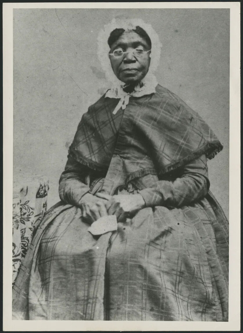
As more enslaved people became free, New Hampshire’s population of free Black people grew larger. Most free Black people in New Hampshire lived in Portsmouth during the colonial period. Black people, both free and enslaved, established an important community in Portsmouth. They developed their own traditions and culture, which included music, dancing, and storytelling.
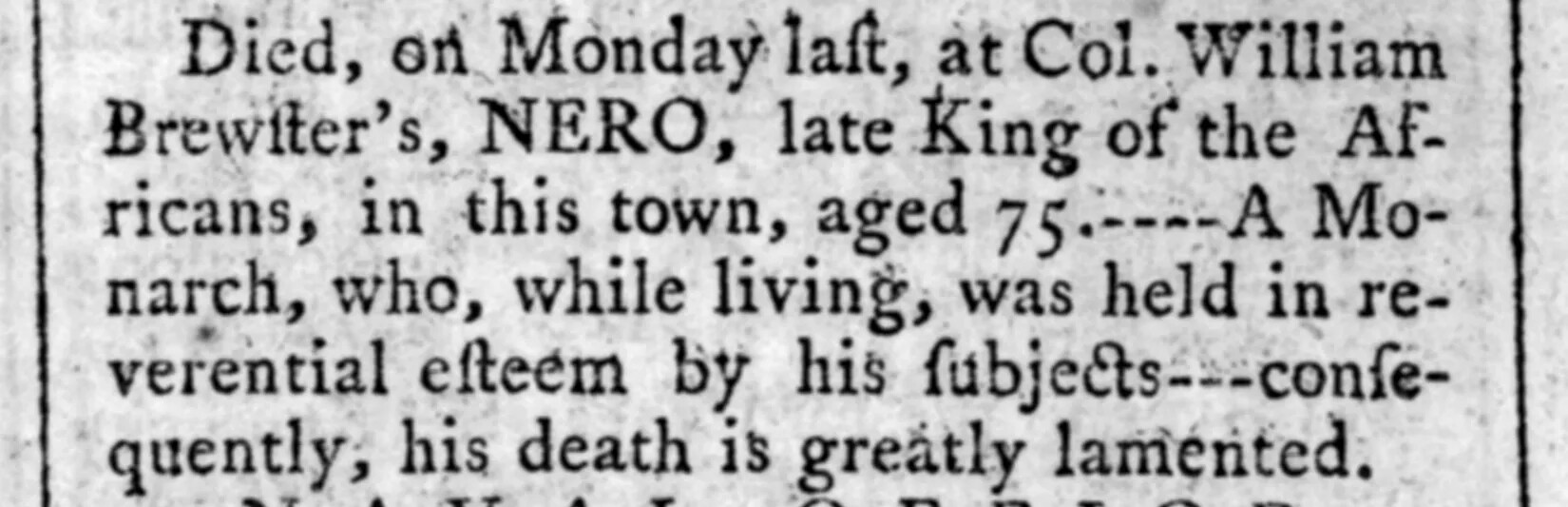
The Black community even had its own holidays, like Negro Election Day. The word “Negro” isn’t a word we use today, but it was common in the 18th century.
On Negro Election Day, the Black people in Portsmouth came together to celebrate their community. They shared food, wore colorful clothes, played music, sang songs, and danced. They also elected a leader for the community who was called the “King of the Africans.”
For the next year, the king provided guidance for the Black community. He helped settle arguments, and he represented the Black community in Portsmouth.
As the 18th century went on, slavery became less popular in New Hampshire. There were fewer enslaved people and more free Black people in the colony. Black people also began moving to other towns than Portsmouth in New Hampshire. Many towns had Black residents during this period.
Who were the Scots-Irish, and what did they contribute to New Hampshire?
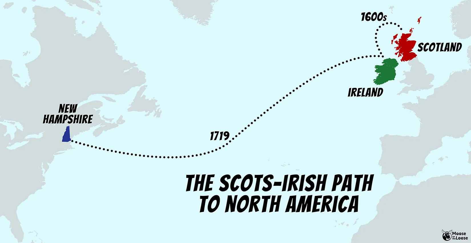
In 1719, a new group of people came to New Hampshire called the Scots-Irish. They were originally from the country of Scotland, which is part of Great Britain. In the 1600s, they moved to Ireland, which was a British colony. That’s how they got their name—they were Scottish people who moved to Ireland.
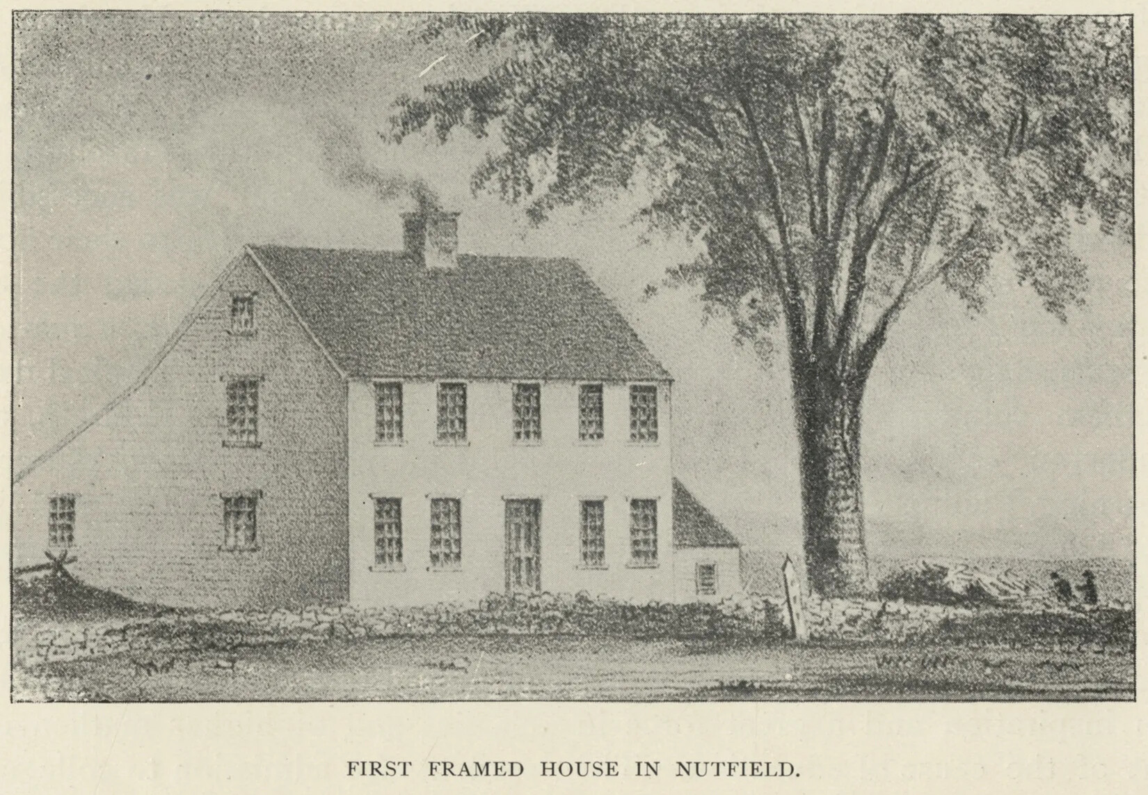
The Scots-Irish wanted more land than they had in Ireland, so in the early 1700s, they came to America. After arriving in Boston, a group of 16 families went north to New Hampshire. They had heard about some land in a valley that was full of nut trees in the Merrimack River Valley.
The Scots-Irish built a settlement on the banks of the Merrimack River. At first, they named it Nutfield because of all the nut trees, but they soon changed the name of their community to Londonderry, naming it after a town in Ireland.
When the Scots-Irish arrived in the Merrimack River Valley, they were the only settlers living in this part of New Hampshire. (The Abenaki had moved to northern New Hampshire years earlier.) Soon, many more Scots-Irish people joined the Scots-Irish in New Hampshire.
Some built farms in Londonderry, but others settled new towns, first in the Merrimack River Valley and then throughout all of New Hampshire.
The Scots-Irish brought different traditions and culture to New Hampshire, including new kinds of crops to grow on their farms, such as the potato. Potatoes became an important source of food for Americans.
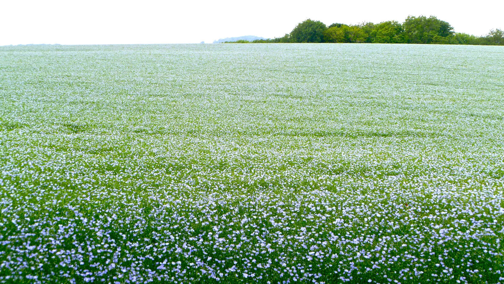
The Scots-Irish also brought flax, which is a kind of grain that people use to make rope and a type of cloth called linen. Londonderry became famous for its linen, which was used to make shirts and other clothing.
The Scots-Irish were known for being hard workers. They lived simply and did not like to spend their money on unnecessary things. This is called being frugal. They also became known for being practical and independent. These traits—hard-working, frugal, practical, and independent—later became part of what it meant to be a New England Yankee.
Many people who live in New Hampshire today have Scots-Irish ancestors.
How did settlement spread throughout New Hampshire during the 18th century?
The Scots-Irish weren’t the only settlers to come to New Hampshire in the 18th century. Many settlers from Massachusetts moved to New Hampshire during this period as well. They were looking for more land to farm. They founded towns across all of southern New Hampshire and even explored north into the Lakes Region and up the Connecticut River Valley. A few of these settlers even traveled through the White Mountains and into the Great North Woods. Most of New Hampshire’s towns were settled during this period.
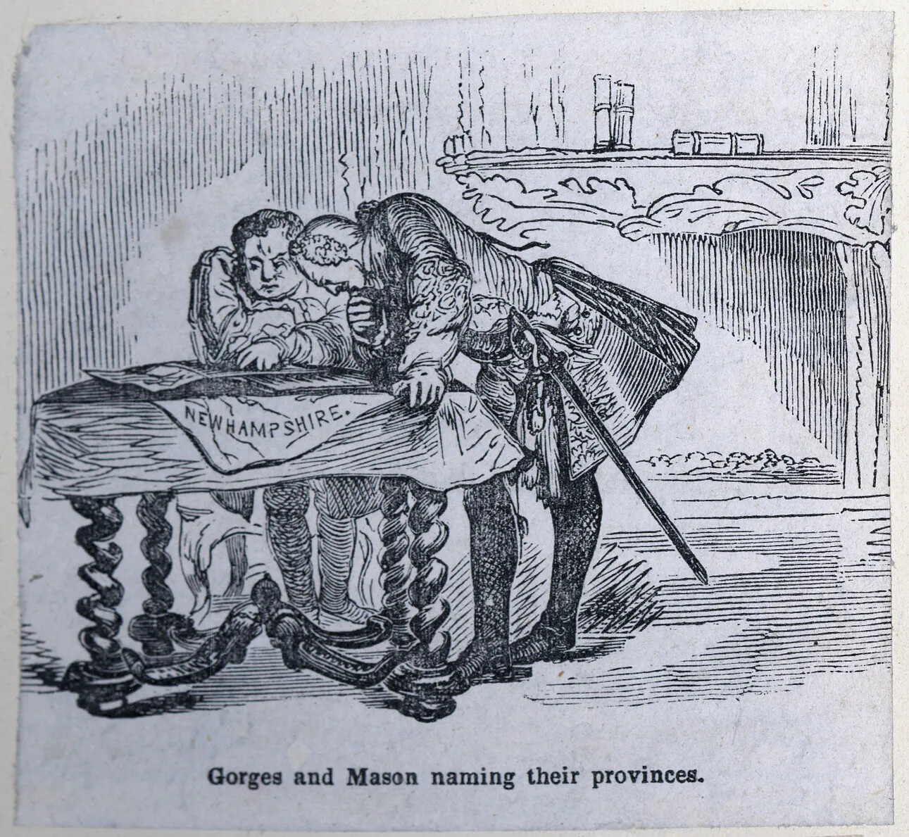
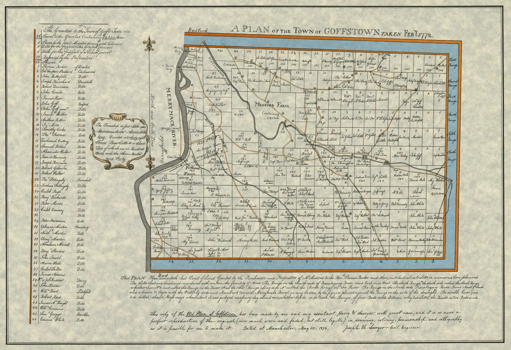
People couldn’t just show up and start farming the land, though. They had to become the owners of the land first. In the 1740s, the unsettled parts of New Hampshire were owned by a group of Portsmouth merchants known as the Masonian Proprietors. The group was named after one of colonial New Hampshire’s earliest settlers, John Mason.
The Masonian Proprietors divided up all the land they owned into townships. Then they gave each township to a group of settlers who wanted to set up a new town. The Masonian Proprietors gave the settlers a charter for the town, which made the settlers the owners of the land. But the settlers had to promise the Masonian Proprietors that they would settle the town quickly. The Masonian Proprietors kept a few parcels of land in each town for themselves.
In each town, the settlers divided up the land into lots and gave lots to all the people who wanted to live there. To keep their land, though, each family had to build a house and start to farm the land within a few years. Otherwise ownership of the land would go back to the town.
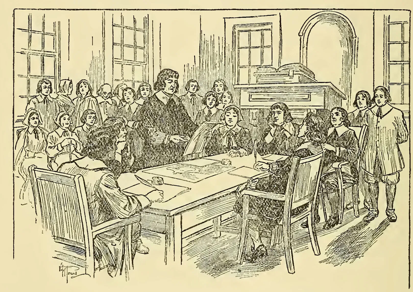
The settlers also had to form a town government. The people in each town elected men to lead the town. These men were called selectmen. Many towns in New Hampshire are still governed today by a board of selectmen and selectwomen. Although the selectmen were the town leaders, the people in each town made a lot of the decisions for the community in their town meeting.
Town meetings were held at least once a year and almost always in March. In the 18th century, town meetings were almost like community fairs. Families would come to the meeting and talk with friends, share food, and play games. The men would also spend time together making decisions for the town, like whether to build a school or how much money to spend fixing a bridge. This tradition of everyone coming together to make decisions for the community is still a very important one in New Hampshire.
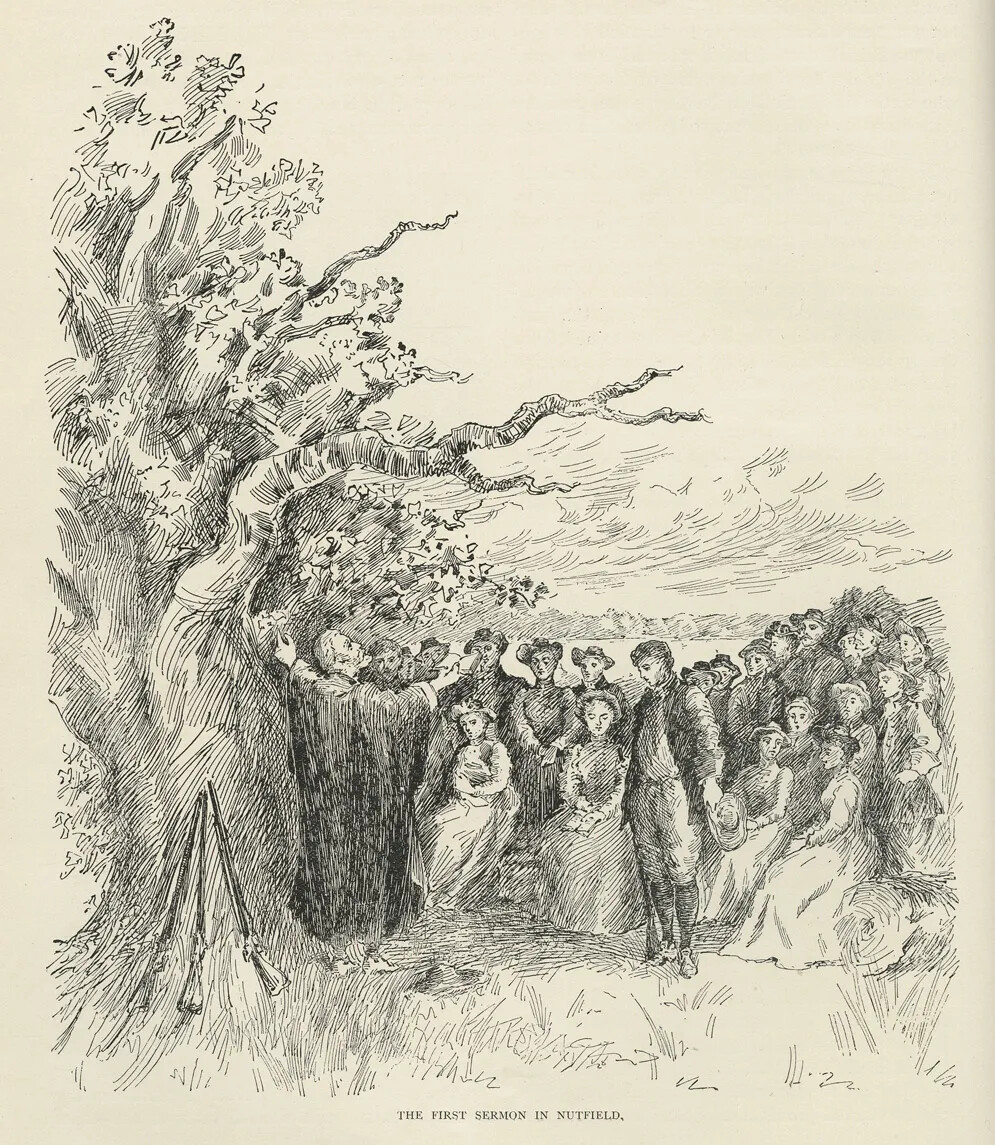
According to the town charter, the people who settled in these communities had to build a meeting house where the townspeople could come together for town meetings or for church services.
They also had to set aside land for a school and a cemetery.
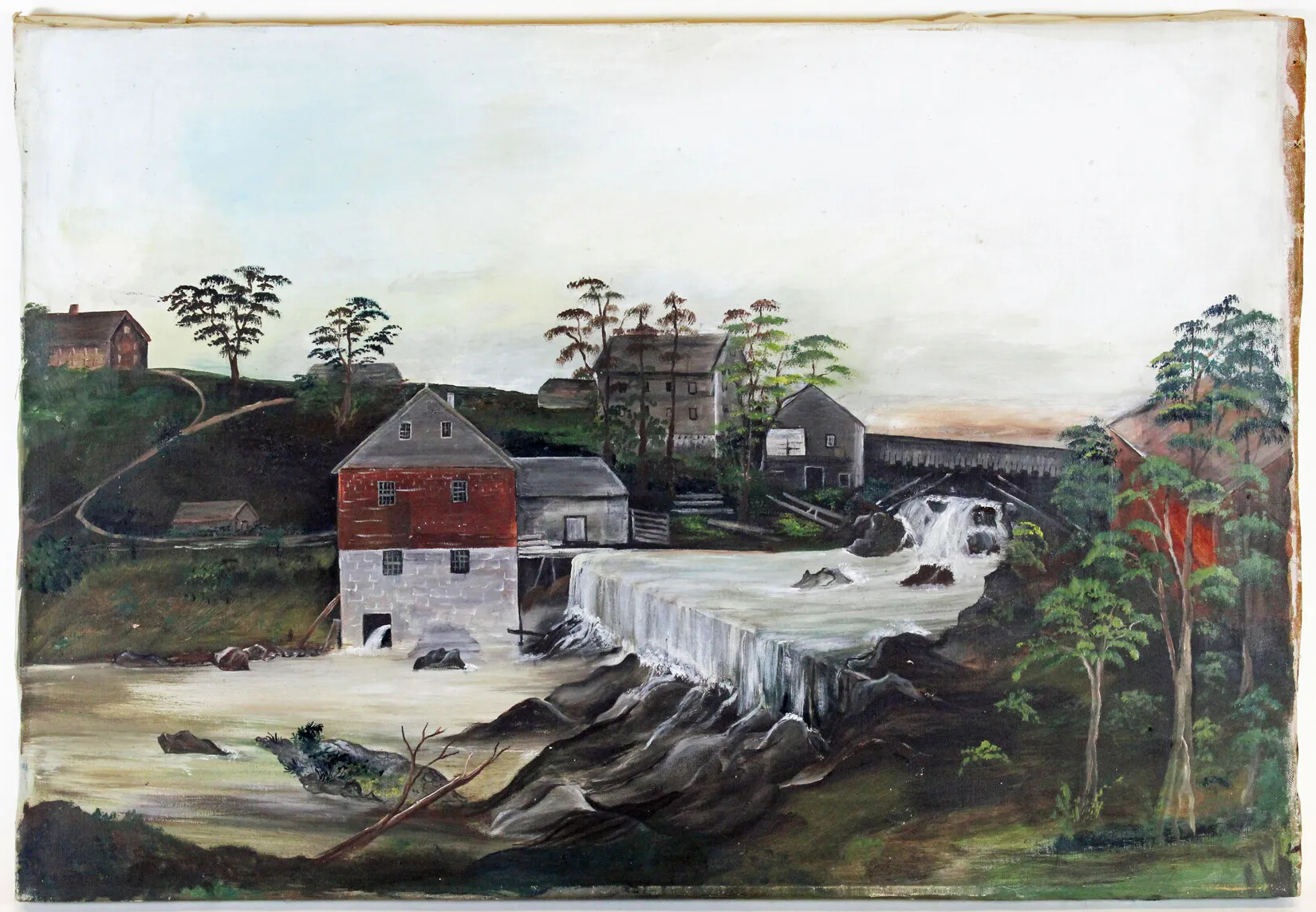
And they had to build a grainmill, which turns crops like wheat and corn into flour, and a sawmill, which turned trees into lumber.
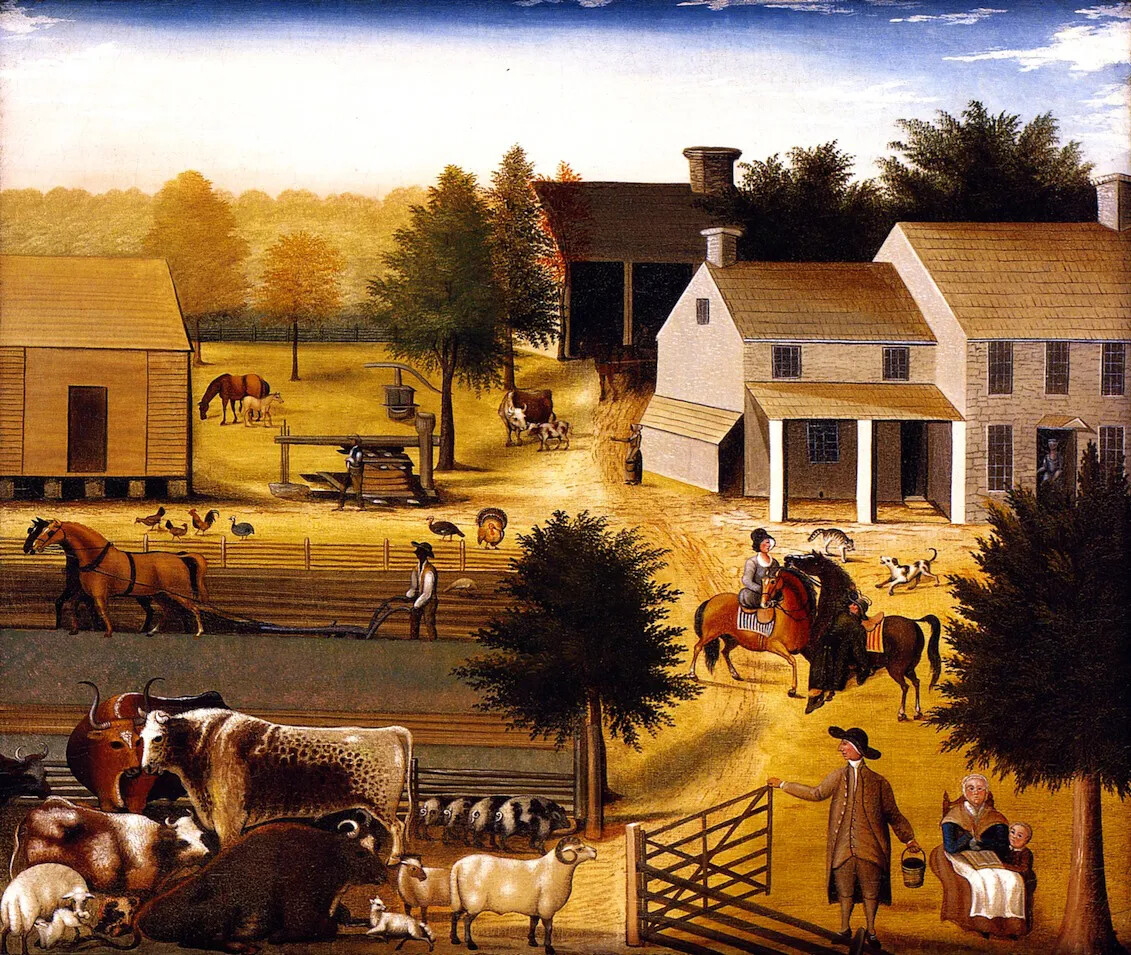
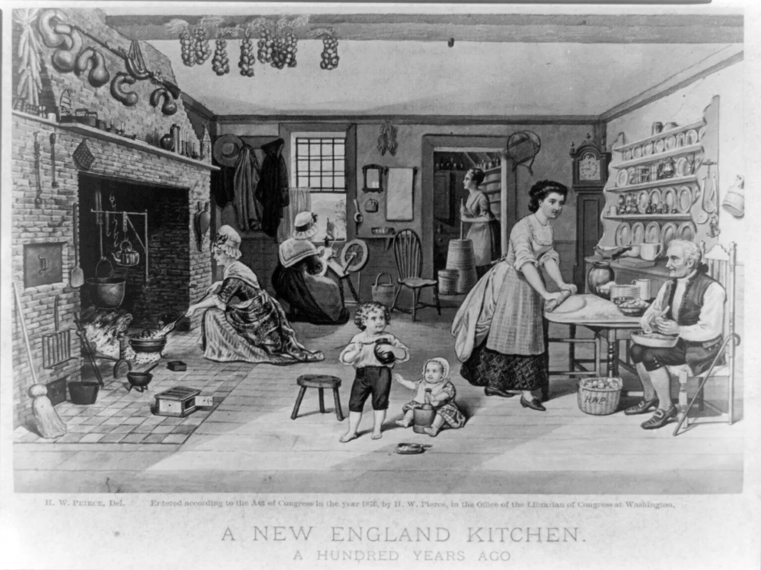
Almost everyone who settled in these New Hampshire towns was a farmer. In colonial New Hampshire, farming involved everyone in the family.
Men and older boys worked in the fields and with large animals like horses, cows, oxen, and sheep.
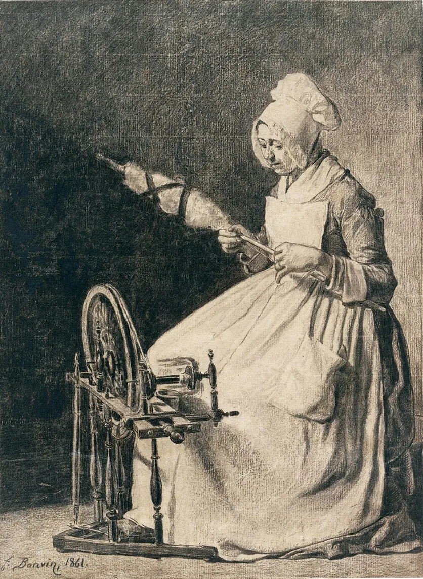
Women and older girls took care of the house, sewed clothing, tended the garden, prepared all the food, and watched over the children.
Even very young children had important jobs to do on a farm, such as taking care of small animals like chickens or helping their mothers around the house.
Farms in New Hampshire produced many goods.
There were fields of crops, like wheat, rye, or corn.
There were orchards of apples and pears.
There were lots of farm animals to produce meat, leather, and other goods like wool (from sheep) or eggs (from chickens).
Farm families had gardens to grow all kinds of vegetables, like beans, squash, and corn.
They hunted and fished to provide food for their families.
They also gathered wild fruit and berries.
They kept bee hives to produce honey and made maple syrup from tree sap.
Farming was hard work in New Hampshire because the soil is rocky and the growing season is short. Most farmers did well, though. They produced enough to support their families and often had some goods left over to barter with their neighbors or sell at market.
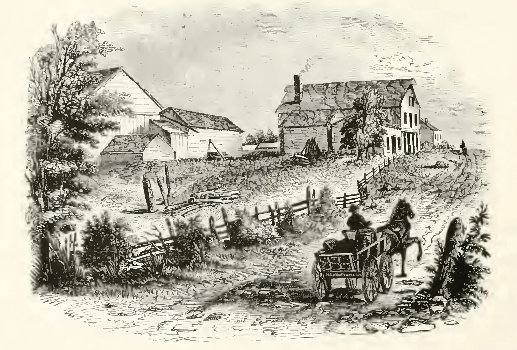
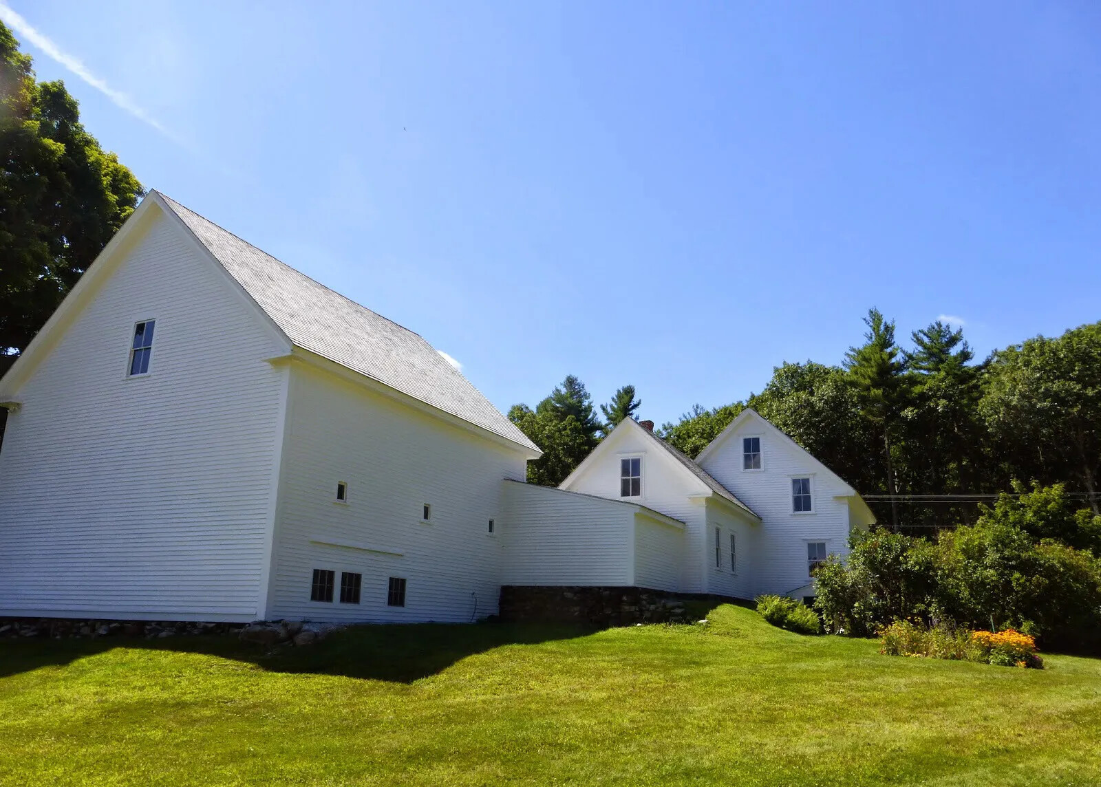
Most New Hampshire farms started off with a small house but then added to it as the farm produced more goods. Farm families who were doing well built a bigger house at the back of the small house or built a room that linked the house to the barn. These types of buildings are called connected houses because the different parts of the house are connected together.
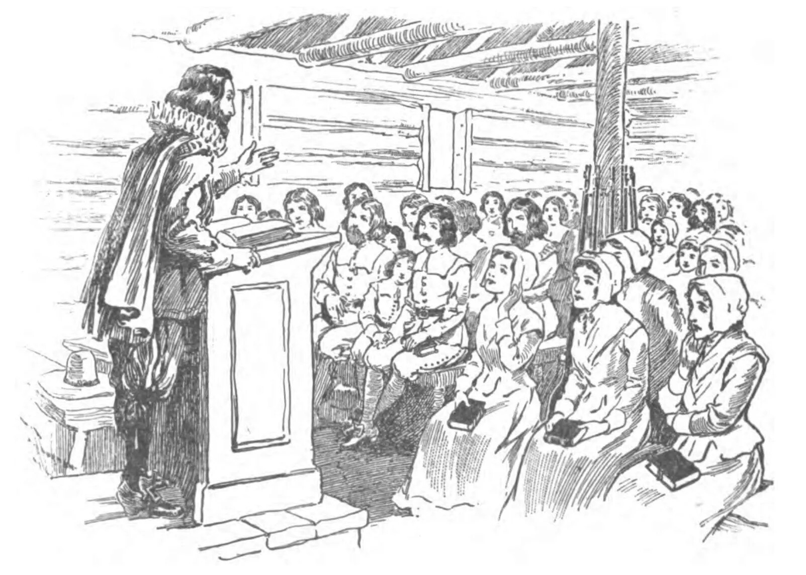
For most people, their lives were focused on their farms and their towns. There were not very many roads in the colonial period, so it was hard to travel very far, and it took a long time to get anywhere. Most people spent their time with their own families or with other families who lived nearby. The whole town came together for town meeting once or twice a year, and they came together for church services, which were often once a week.
Religion played a big role in people’s lives in the 18th century. The townspeople paid taxes for a minister to live in the town and conduct church services. On Sundays, church services often lasted all day, with one service in the morning and then another service in the afternoon. Since the meeting house wasn’t heated, it could get very cold for people attending services in the winter.
The town’s minister often served as the schoolmaster as well. Children spent much less time in school in the 18th century because they had to work on their families’ farms. Sometimes, kids would only attend school for 8 or 10 weeks a year!
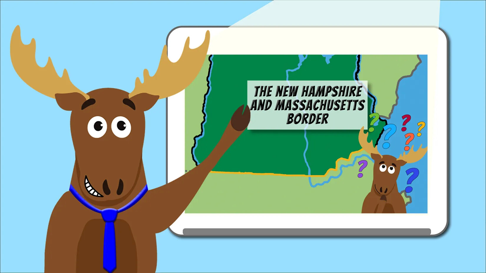
How did New Hampshire settle its arguments with Massachusetts?
During the colonial period, New Hampshire and Massachusetts had a lot in common. In fact, many of New Hampshire’s early settlers came from Massachusetts. In the 1670s and 1680s, New Hampshire was even part of Massachusetts instead of being its own colony.
By the early 1700s, the two colonies were separate again, and each colony had its own legislature, or form of government. New Hampshire and Massachusetts shared a governor, though. One person was the governor for both colonies at the same time.
Massachusetts also claimed that most of southern New Hampshire was really part of Massachusetts. In the 1720s and 1730s, the Massachusetts government settled its own towns in New Hampshire and gave land to Massachusetts people who were willing to move there. A lot of people were confused about where the border was between the two colonies and who had the right to give them the land they needed to settle and start a farm.
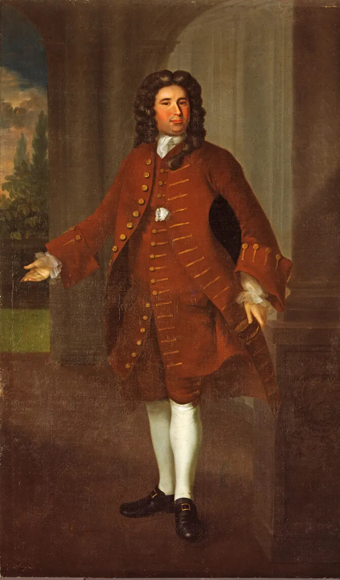
Once New Hampshire’s southern border was set, the people of New Hampshire pushed the British government to give them their own governor. They didn’t want to share a governor with Massachusetts anymore because the governor usually didn’t pay much attention to New Hampshire.
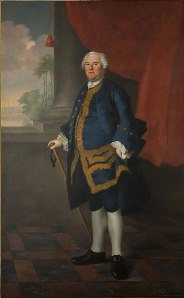
In 1740, the British king named a new governor just for New Hampshire. His name was Benning Wentworth. His family had lived in New Hampshire for a long time and played a big role in New Hampshire’s colonial government. Benning Wentworth was New Hampshire’s first governor.
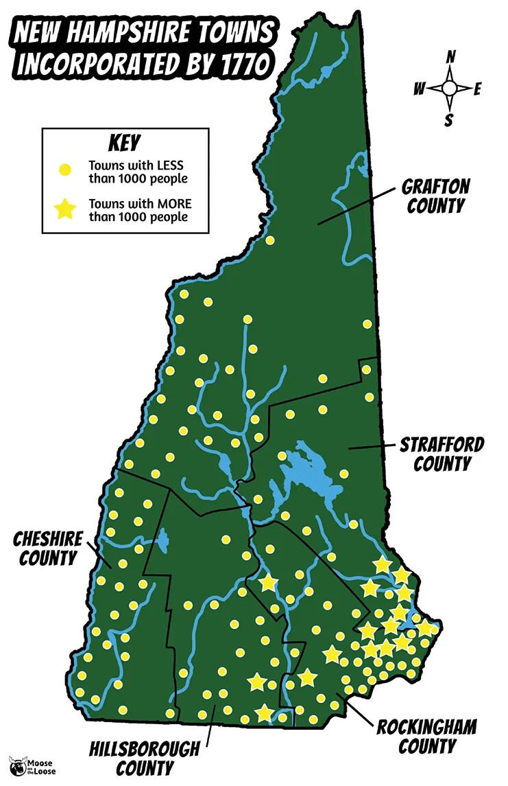
Once all these arguments with Massachusetts were settled, even more people started to move to New Hampshire. In fact, New Hampshire’s population went from just 9,000 people in 1720 to 60,000 people in 1770. New Hampshire grew faster during these decades than it did at any other time in its history. More than 150 towns had been settled in New Hampshire by 1770.
In fact, New Hampshire’s population had grown so big that the government decided to create counties to help organize them. Five counties were established in New Hampshire in 1769. Because New Hampshire was still a British colony at the time, all five counties were named after people or places in Great Britain. The counties were called Cheshire, Grafton, Hillsborough, Rockingham, and Strafford. You might live in one of those counties today!
Most of the government in New Hampshire was still done at the town level, though. Local government allowed people the most control over how they lived, which is still a New Hampshire tradition in our own times.
How did the French and Indian War affect New Hampshire?
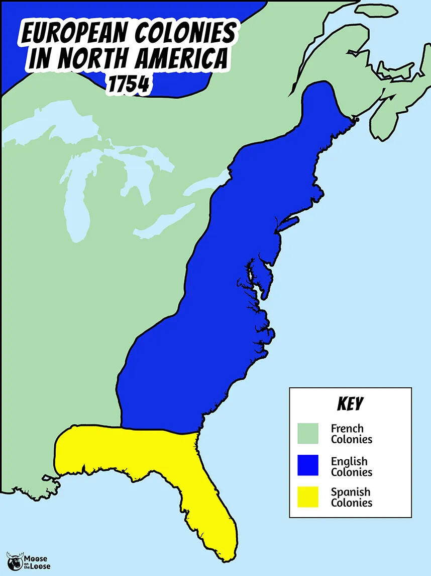
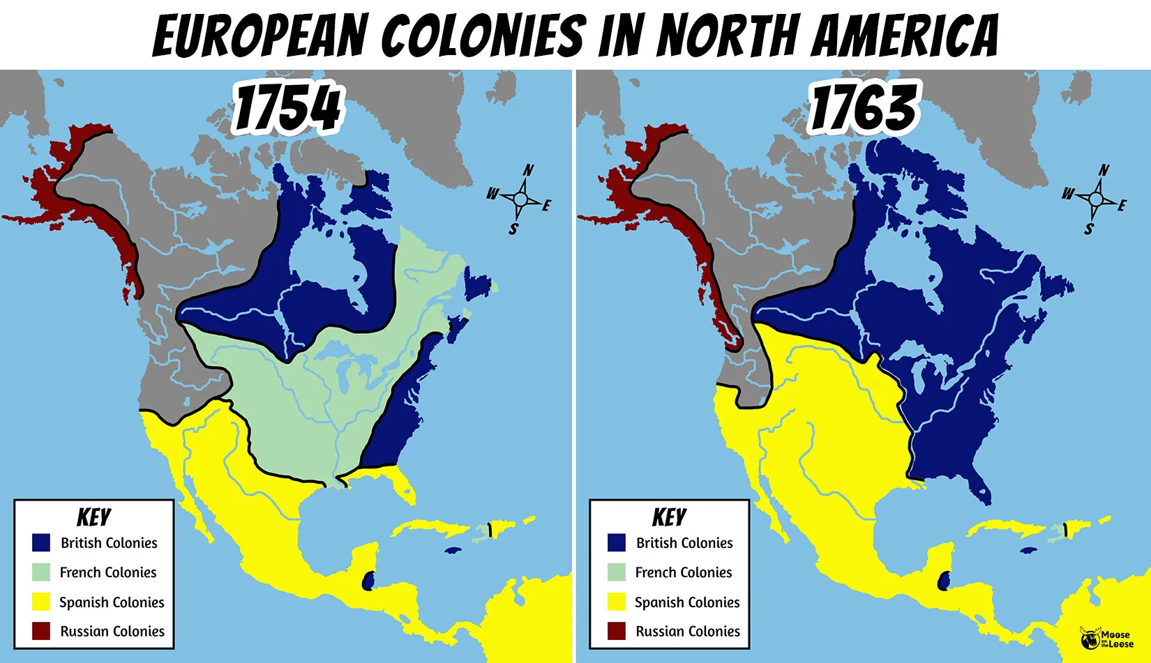
New Hampshire was one of many British colonies in America during the 1600s and 1700s, and Great Britain wasn’t the only European country to have colonies in North America. The French had a colony north of New Hampshire that they called New France. Today, we know it as Canada. The French also had colonies in the central and southern parts of America, along the Mississippi River and the Gulf of Mexico. Spain had colonies in the southern part of America, too.
France and Great Britain were rivals in Europe and North America. They competed with one another over everything, and they were often at war during this period. Although most of the fighting was in Europe, the people living in the French and British colonies fought each other too. In fact, it seems like Britain and France were at war almost all the time in the 1600s and 1700s.
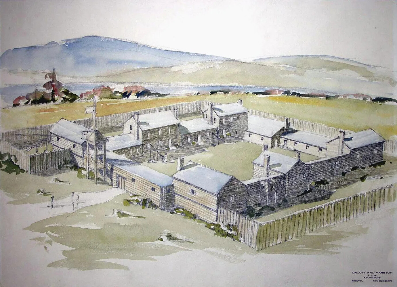
In 1744, the colonists built a fort on the Connecticut River that they named the Fort at Number 4. At that time, this fort was the British outpost that was farthest north, so it was an important fort for the British to hold. They needed to protect British settlers from the French in Canada.
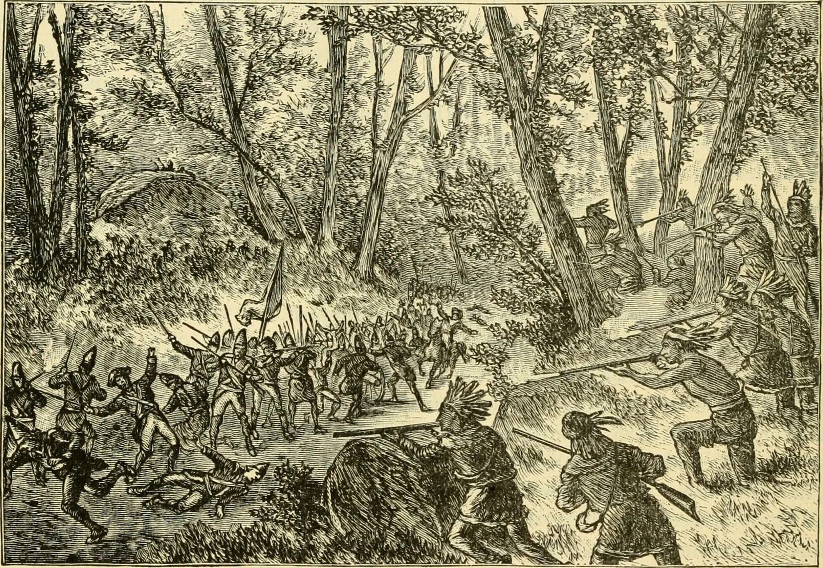
In 1754, another war broke out between the British and the French. This war ended up being one of the biggest wars between the two countries in the 18th century. The part of the war that was fought in America became known as the French and Indian War.
Most of the indigenous population (who were called Indians in colonial times) fought on the same side as the French. The American colonists fought on the same side as the British.
No battles were fought in New Hampshire during the French and Indian War, but the war had a big impact on the colony.
When the French and Indian War broke out, most of the fighting was west of New Hampshire, in places like Pennsylvania and New York. The French and their Native American allies organized attacks on the British and American forces by coming down from Canada through the Hudson River Valley in New York.
The British built a number of forts in this area that needed to be defended from the French. Many New Hampshire men volunteered to serve with the colonial militia and went to these forts. They fought against the French to keep the French from moving further south.
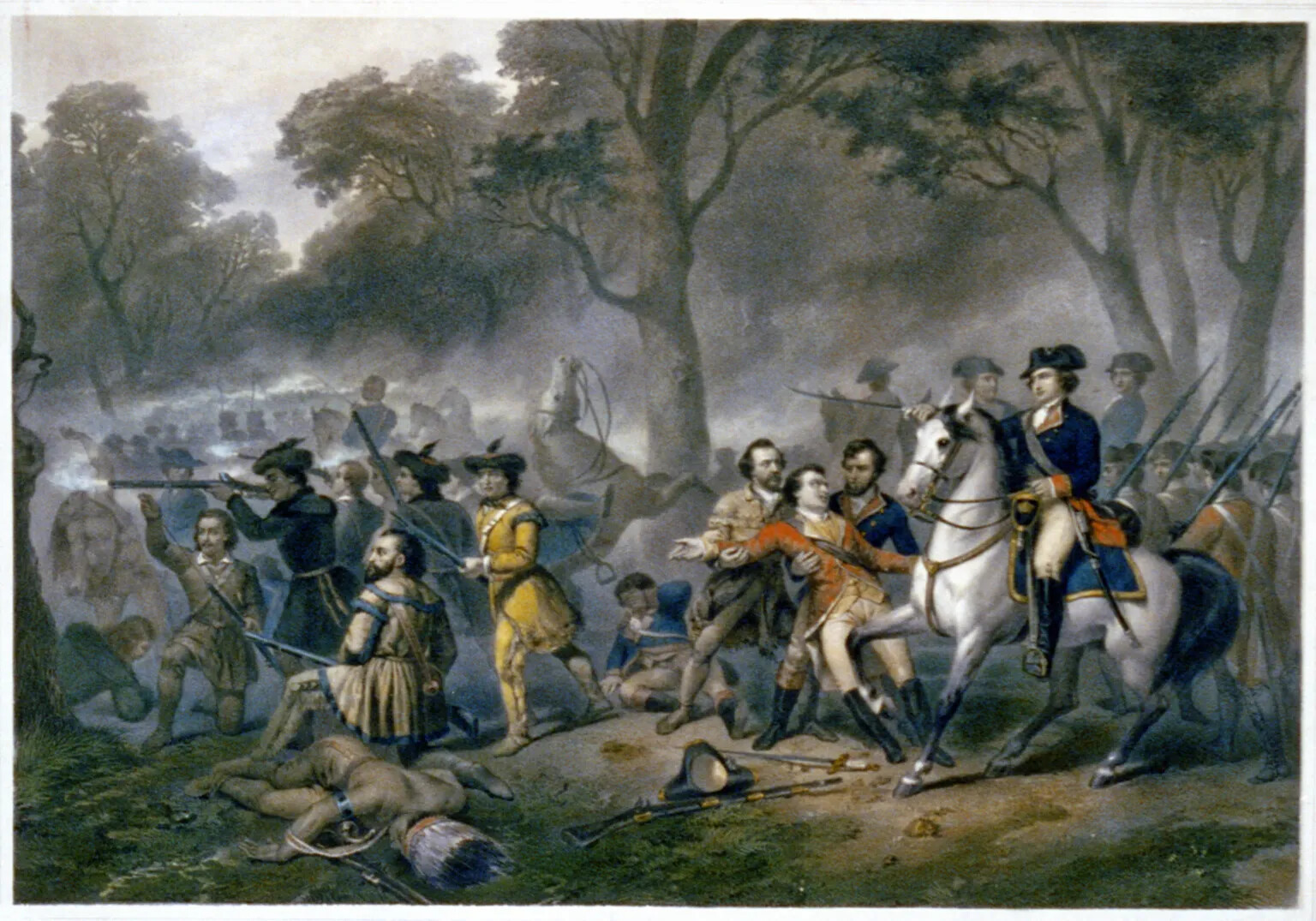
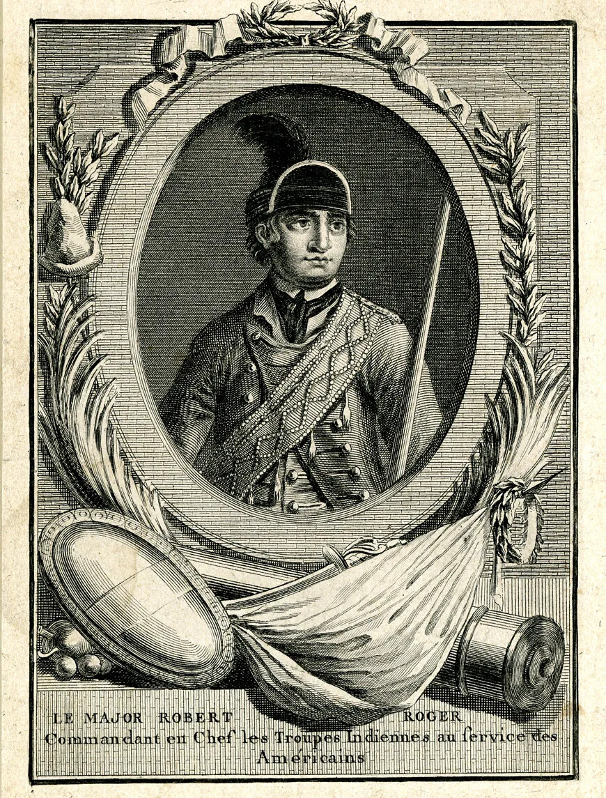
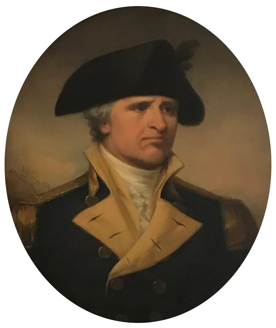
New Hampshire’s most famous soldier during the French and Indian War was Robert Rogers. He commanded a group of New Hampshire men called Rogers’ Rangers. They were very good at moving through forests without anyone hearing or seeing them. They hid behind rocks and trees and learned how to blend into their surroundings so it was hard to spot them. Because they were so good at moving around without anyone knowing they were there, Rogers’ Rangers were scouts for the British Army.
One of the men serving in Rogers’ Rangers was a young man named John Stark. He would someday become New Hampshire’s most famous general during the American Revolution.
The fighting was far away from New Hampshire during the French and Indian War, but New Hampshire had a lot of men and supplies that the British needed for the fighting in New York. To get to New York, though, New Hampshire soldiers had to travel through Vermont first. But there was no easy way to get across Vermont at that time, as there were hardly any settlers living in that area. It was mostly forests and mountains.
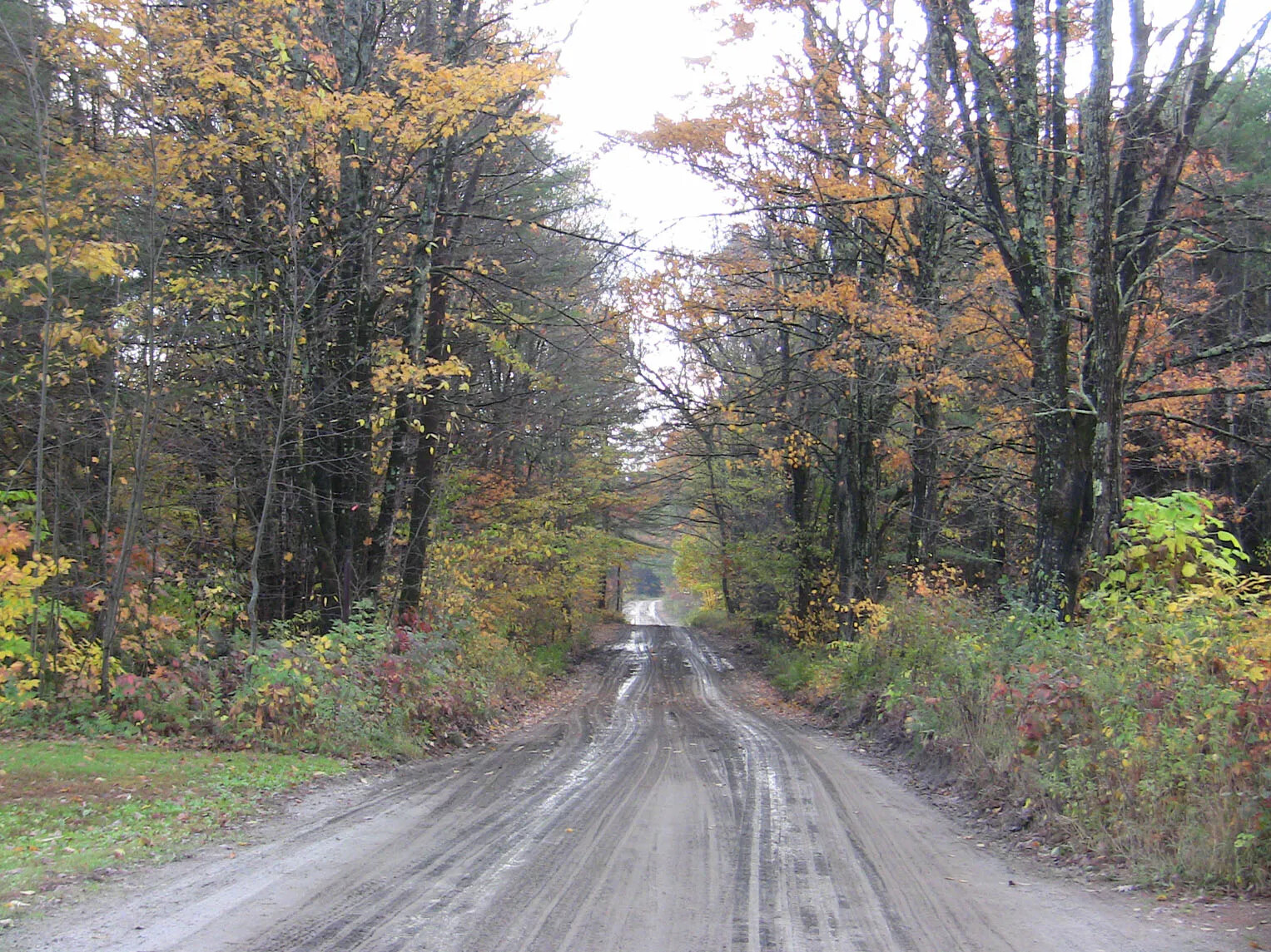
New Hampshire soldiers built a road from the Fort at Number 4 across Vermont to the Hudson River Valley in New York. This road was called the Crown Point Road. It took the soldiers more than a year to build the road across the Green Mountains of Vermont. When the road was finished, it helped get the men and supplies the British needed to defeat the French in New York. After the war, when many people started moving to Vermont, settlers built towns along the Crown Point Road. Parts of the road still exist in Vermont today.
The British and Americans won the French and Indian War in 1763. The French had to give New France, their colony in North America, to the British. The British gave New France a new name—Canada.
The people of New Hampshire were very happy that the French were gone from their northern border. Without the French living so close to them, the colonists felt free to explore northern New Hampshire and build settlements there.
The French and Indian War also changed the way people in New Hampshire saw their colony. Before the war, they had spent almost all their time in their own towns, and they didn’t think much about the other towns in New Hampshire. Fighting the French and Indian War made people realize that they had a connection to the rest of the people living in New Hampshire.
They also started to feel a greater connection to the other colonists in North America. More than ever before, they began to see themselves as Americans.
A printable version of the student reading for this unit, without pictures or graphics.